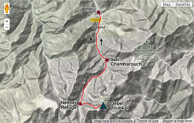
The Route: Jebel Toubkal | Distance: 10.6km | Time: 7 Hours Height gain: 1866m | Max Altitude: 3207m | Start: Imlil Village | Finish: Neltner Refuge Map: Orientazion – Toubkal Hiking Map ISBN: 9788493560003 | Date: 07/06/2014
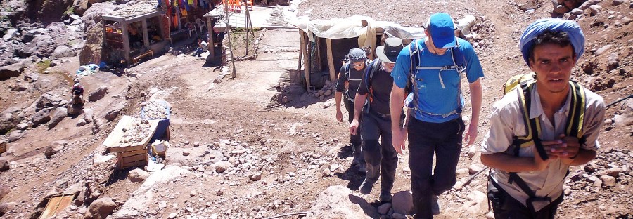
I arrived with my new best friends in the village of Imlil. Imlil is the gateway to the Atlas Mountains and the start point for our trek. From here on in there was only one way and it all led uphill! We all stocked up on water supplies from a small tea shop on the edge of the main street through the village while our newly acquired muleteer loaded up our mule for the journey. Our main holdalls would be carried by mule up to the Neltner Refuge, beyond that point the mule don’t go, so we would be carrying our daysacks from that point on. Continue reading “Jebel Toubkal Challenge – Day 2” →