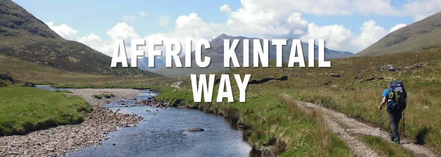
In 2016 I managed to persuade my brother-in-law to join me on a little hiking and camping adventure up in the wilds of Scotland. The idea was a simple one, to walk the length of the newly created Affric-Kintail Way which runs from Drumnadrochit on the shores of Loch Ness, to Morvich in Kintail on the western seaboard, a total distance of 44 miles or 71 km.
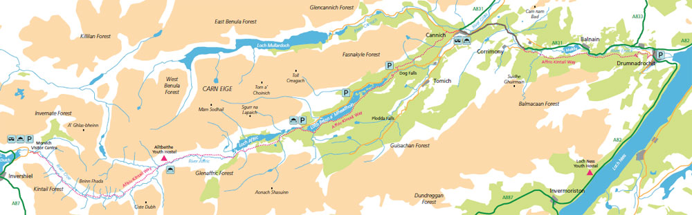
The route initially runs through dense forests high above Glen Urquhart before reaching the village of Cannich in Strathglass. It then continues up Glen Affric through ancient Scottish pinewoods, past several stunning lochs and eventually up through the wild and remote upper reaches of the glen surrounded by Munros. Finally the route climbs steeply over a main watershed before descending through the mountainous landscape of Kintail below the Five Sisters of Kintail.
We had decided we would camp on designated sites where possible but if we couldn’t then we would wild-camp on the shores of the lochs. Add into the mix the chance to stay overnight in Scotland’s most remote youth hostel at Alltbeithe on Stage 3 and you had all the makings of a cracking little adventure.
We broke the route down into four manageable sections to enable us to complete it in the four days we had given ourselves.
Affric-Kintail Way – Stage 1: Drumnadrochit to Cannich – 13.5 miles/21.6km
Affric-Kintail Way – Stage 2: Cannich Village to River Affric – 12.1 miles/19.5km
Affric-Kintail Way – Stage 3: River Affric to Alltbeithe – 8.4 miles/13.5km
Affric-Kintail Way – Stage 4: Alltbeithe to Morvich – 11 miles/15.7km
This is the story of our trip.

We arrived in Inverness on a short flight from London and took a local taxi to the centre of Inverness where we were due to catch a bus from the central bus station to take us along the banks of Loch Ness and down to the small village of Drumnadrochit where we were booked into Borlum Farm to camp overnight. http://www.borlum.co.uk/Camping/Campsite.html. The evening was pleasant and warm by Scottish standards so we took a little wander down into the village for a pint and a meal at the well known Loch Ness Inn. https://www.staylochness.co.uk
Affric-Kintail Way – Stage 1: Drumnadrochit to Cannich – 13.5 miles/21.6km
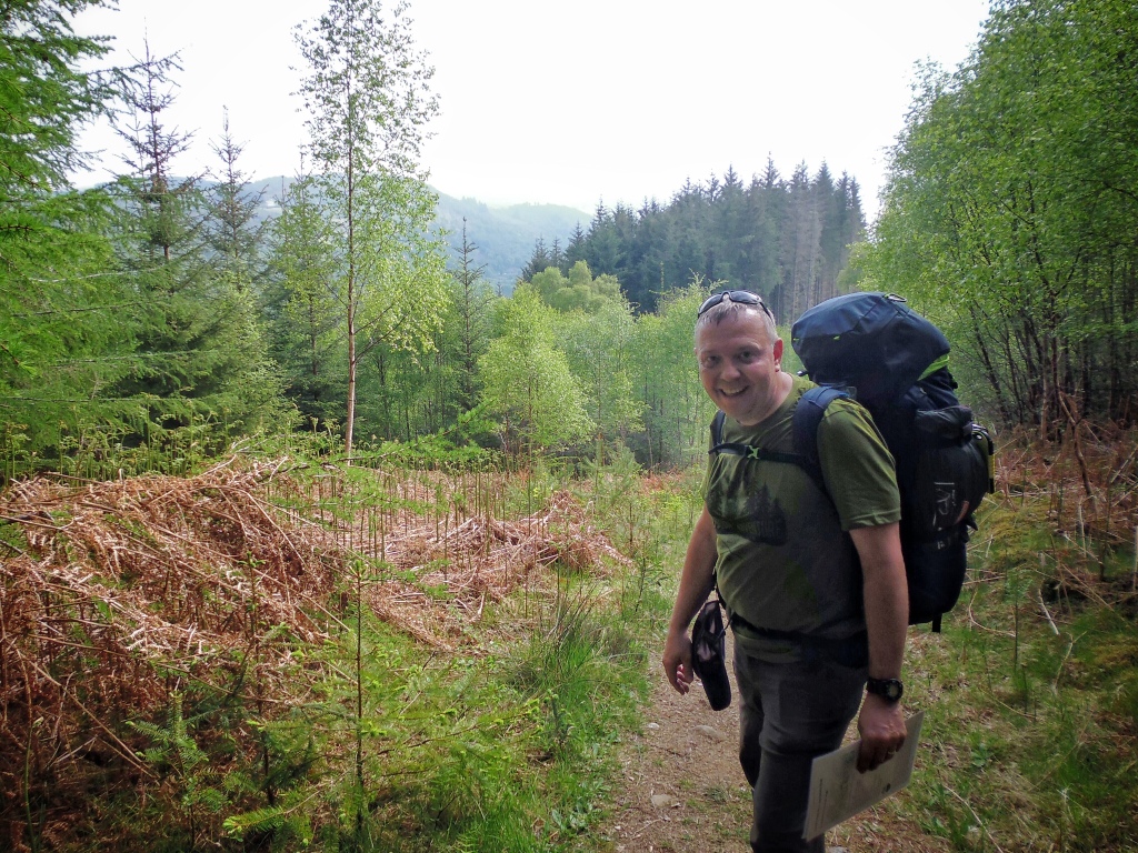
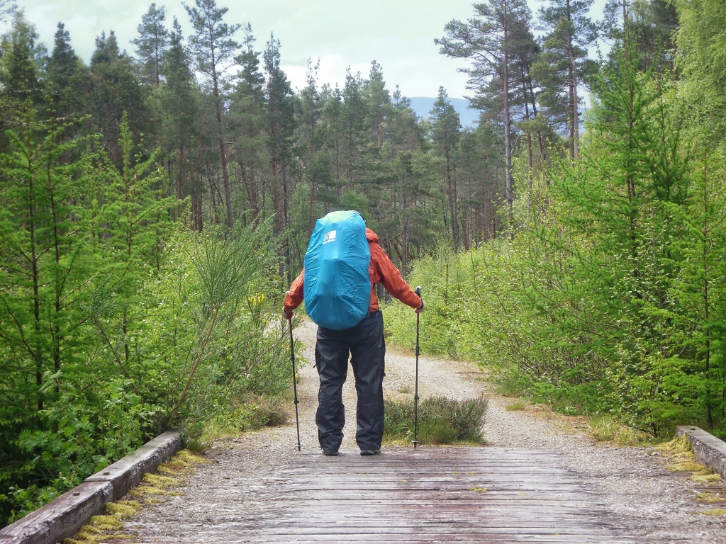
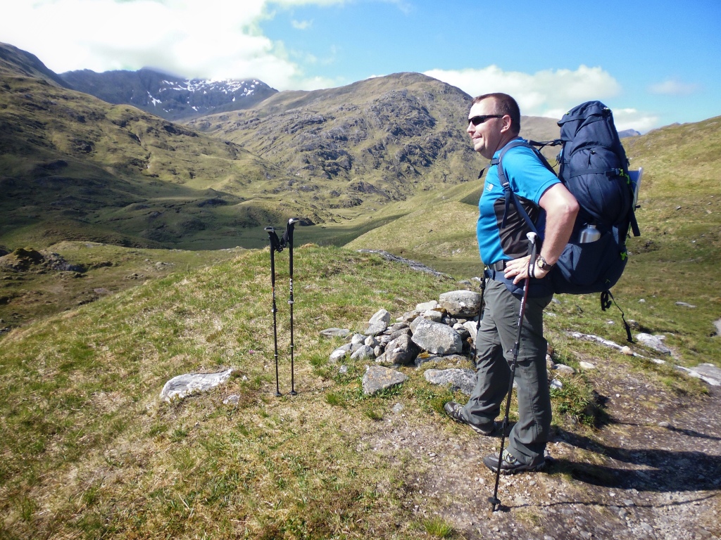
Early the next morning we decamped and hit the tarmac and suddenly we hit with the full weight of our overly laden rucksacks. Predictably we had both overpacked and would end up suffering for this schoolboy error over the next next four days in the form of swollen feet, blisters and generally manky feet.
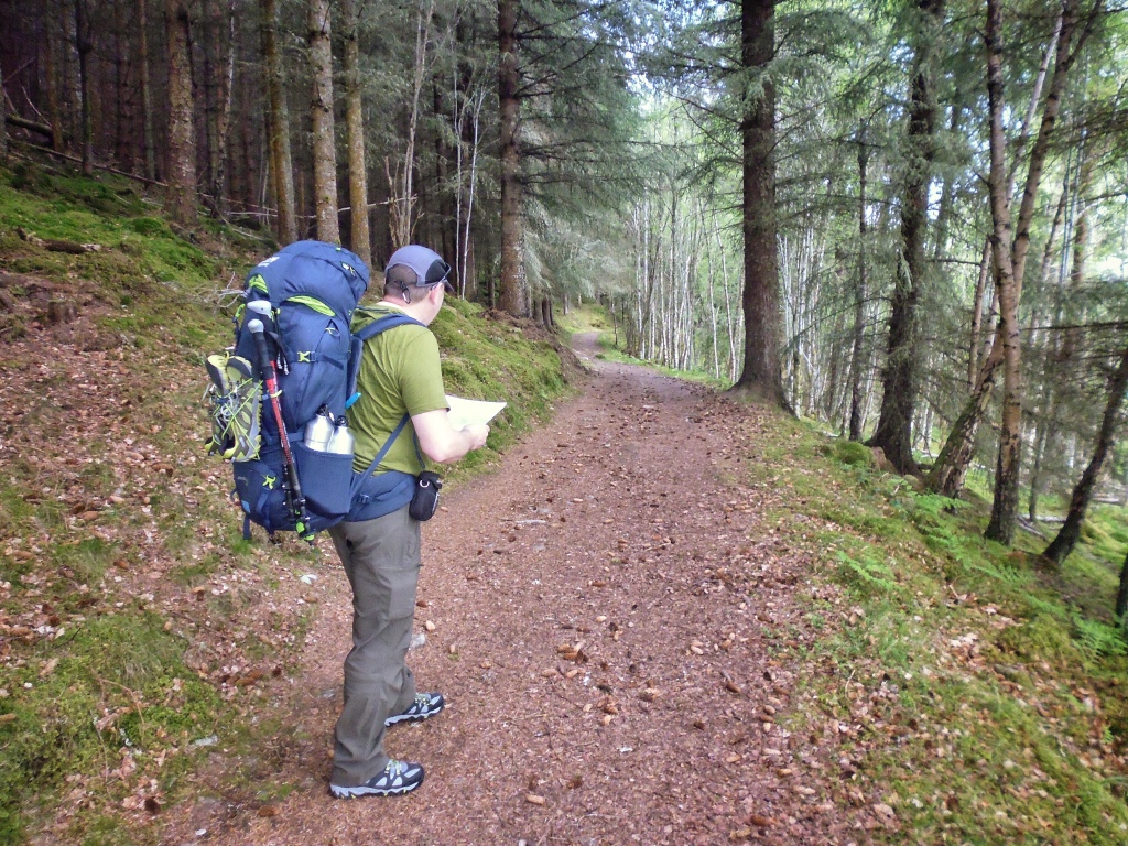
Rising out of Drumnadrochit we quickly hit forestry land for the first but not last time. Much of the first part of the trail is through this heavily forested landscape. Large sections of this part of the route followed man made forest tracks wide enough for a truck to drive along.
The going was monotonous and not a great introduction to the walk. What seemed like hours were spent trudging along these never ending tracks, with views mainly obscured by all the tall pine trees planted regimentally on either side. Luckily there were some sections were the complete opposite was true though, consisting of nice single track trails through interesting and changing woodland affording some nice photo opportunities.
The second loch of the trip Loch Meikle, (Loch Ness being the first) lay somewhere ahead through this dense woodland, reaching it would hopefully herald in some open space with more expansive views for the first time. Finally we exited the wooded canopy and were rewarded with the openness we longed for as we arrived at the small loch. The track from here passed through a farm just prior to the small hamlet of Shenval.
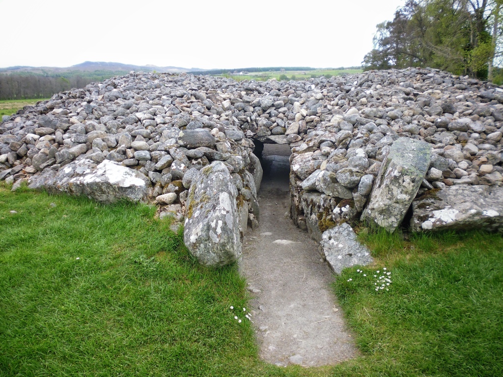
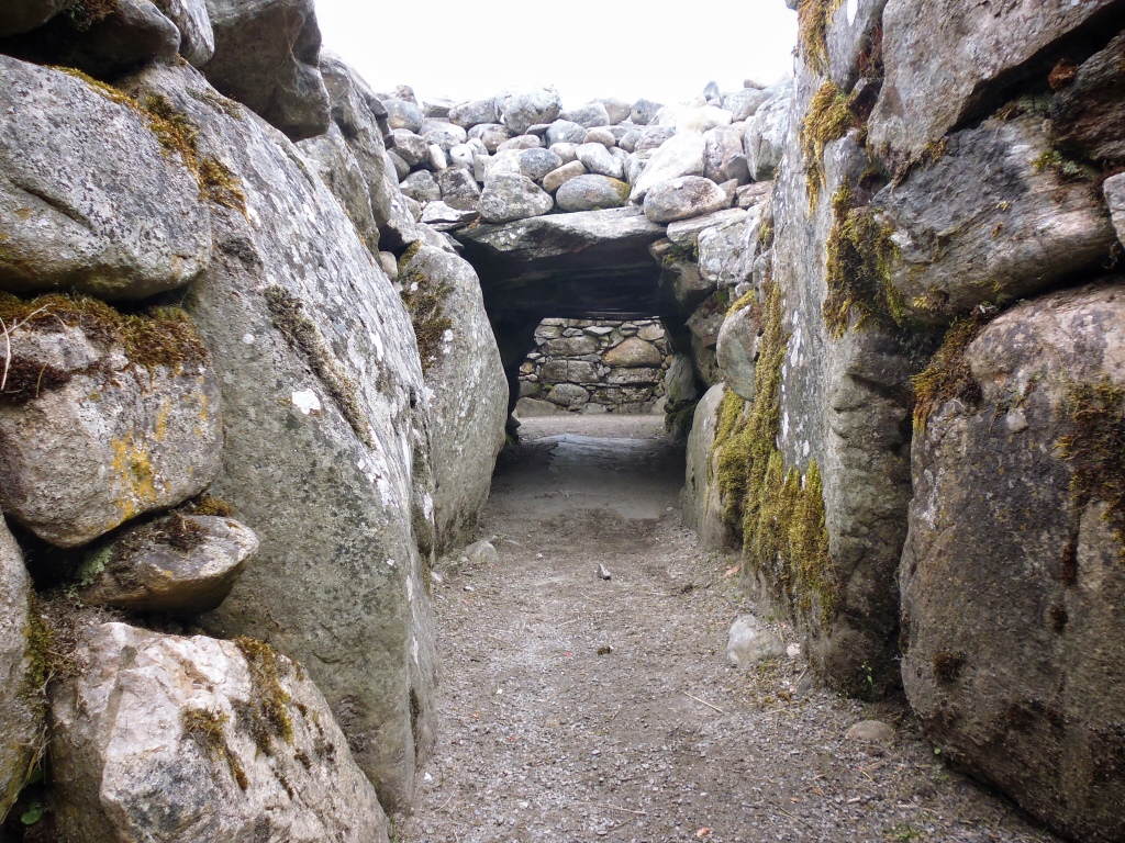
On leaving Shenval by the unlisted road we picked up the forest track once again through yet more woodland heading this time for Corrimony, home to a 4,000 year old Chambered Cairn. Corrimony is the place where legend has it that the Scandinavian Prince Mony died of his wounds following his defeat and retreat from Craigmonie.
We halted at the ancient site for a while to refuel and relax and unburdened our backs from the weight of our stupidly over packed and heavy rucksacks.
Leaving the site after a rejuvenating break we picked up the A831 carefully walking along the side of the road on the soft verge all the way down into Cannich (place of the bog cotton). Unfortunately at the time of writing this is the only way to continue along the route at this point, the road being a bit of an annoyance, although it was not too busy to be dangerous. In earlier times this area Comar was the seat of the Clan Chisholm and there is an association with Bonnie Prince Charlie hereabouts as well as at nearby Fasnakyle following the Jacobite defeat at Culloden in 1746.
Overnight we camped at the beautiful and quiet Cannich Woodland Campsite. The park is surrounded by the hills of Beinn a Chairein, Carn Dubh-Ghlaic and Carn Bingally, and it was beautifully sheltered for the night by the ample Scots pines and birch trees growing throughout the park. http://www.highlandcamping.co.uk/index.html.
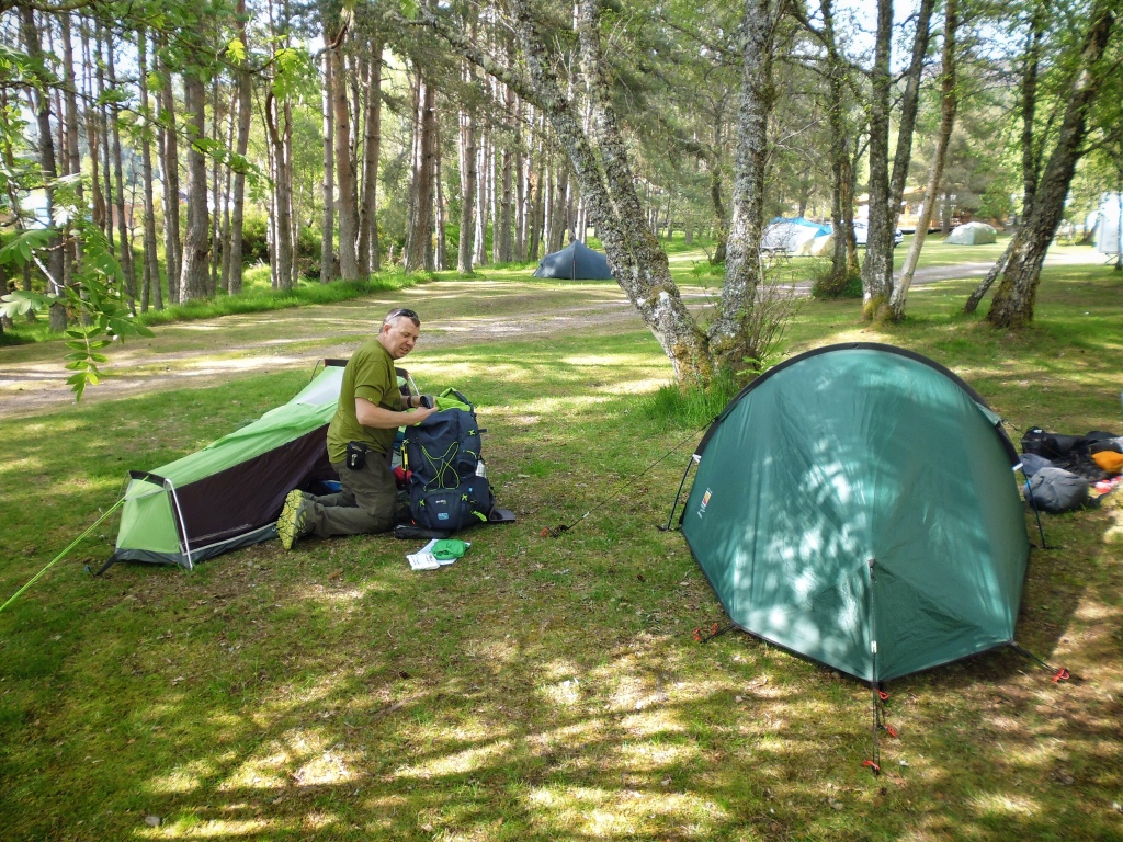
We were not carrying an evening meal in our packs for this second night either so after setting up camp we hobbled along into Cannich to find an Inn for something to eat and drink. We found The Slaters Arms and had a pleasant meal and a pint before an early night. http://www.slatersarms-selfcatering-lochness.com
Affric-Kintail Way – Stage 2: Cannich Village to River Affric – 12.1 miles/19.5km
Stage 2 of the Affric Kintail Way is a stretch of just over 12 miles from the village of Cannich to the River Affric. We woke up to a beautiful morning and lazily broke camp before leaving a wee bit later in the morning than we had anticipated at around 10:00 AM. We faffed around endlessly while attempting to get all our camping gear to fit back neatly into our rucksacks and so we found ourselves already behind schedule before we had even set off. This would result in us not getting in as much mileage as we had hoped for by the end of this the second day!
As we left we walked past the now derelict old Glen Affric Hotel before turning left (signposted) onto another forestry road running above Comar Wood. We passed through several areas that looked like they had seen some recent tree felling that had resulted in an opening up the views along this part of the trail, and a very welcome change it was too to have some views again after so much forestry.
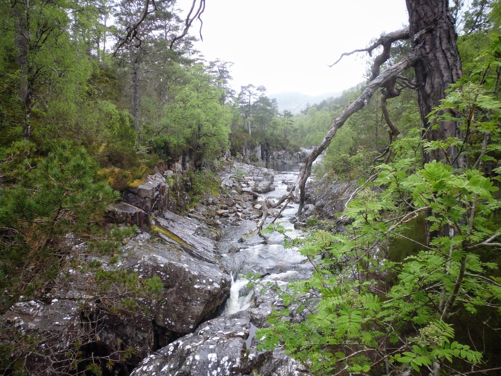
After about another 3 miles the trail left the forestry road by the left (again signposted) and headed downhill on a narrower, rougher track that zig-zagged to a gate on a public road near to Dog Falls.
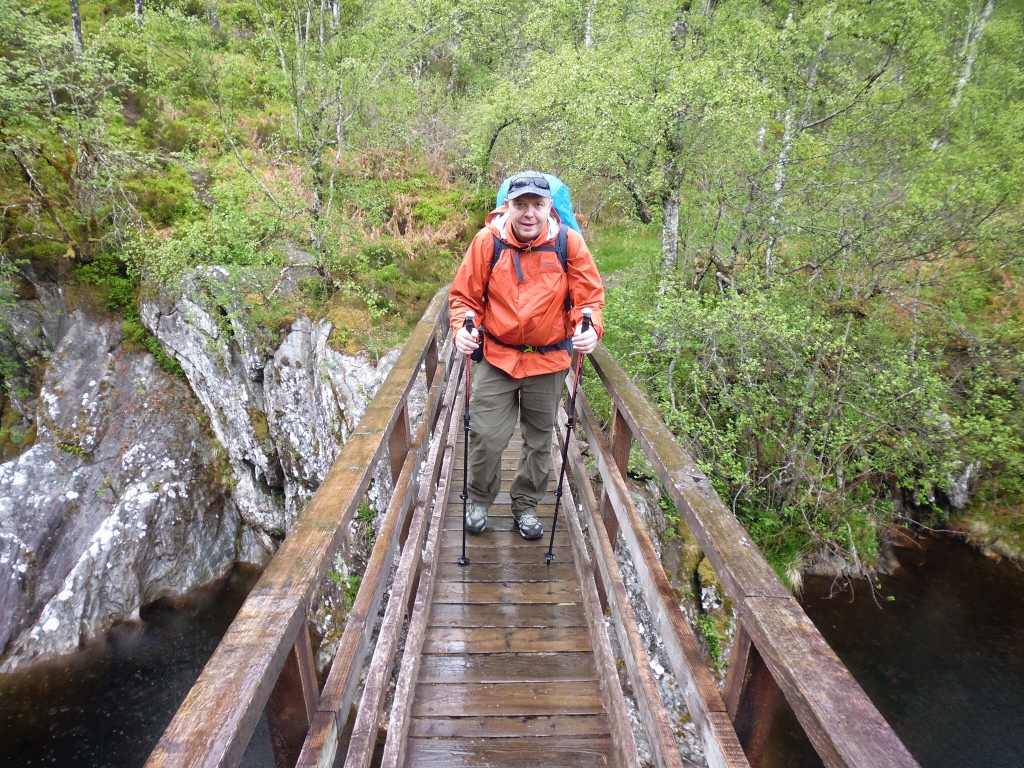
We crossed the wooden bridge over the River Affric and then headed back uphill through more woodland. After a short distance we arrived at the famous Glen Affric Viewpoint where we stopped for a welcome break. Loch Beinn a’ Mheadhoin was now sprawled out below us in spectacular fashion and we could see the entire way along Glen Affric as far as the distant mountains of Mam Sodhail and Carn Eighe, the highest peaks to the north of the Great Glen.
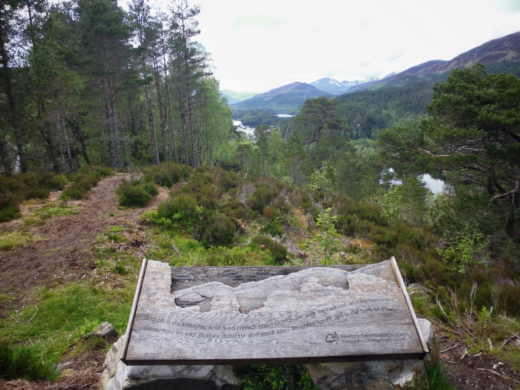
We continued along the side of the loch for what felt like an eternity enjoying the quiet surroundings and spectacular views out over Loch Beinn a’ Mheadhoin. The loch is dotted with small islands which are a result of the raising of the water levels during the construction of several hydro schemes from the early 1950s which resulted in the dam which now sits at the eastern end of the loch. The sides of the loch were quite heavily wooded but there were plenty of opportunities for taking in the spectacular scenery en-route with outstanding views out towards Sgurr na Lapaich and Tom a’ Choinich across the loch.
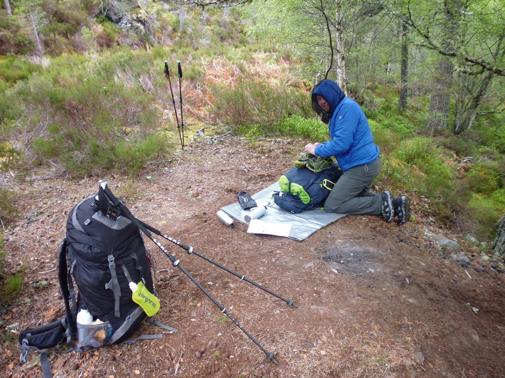
Spectacular views that was until the notoriously fickle Scottish weather decided to change her mind. Ominous clouds that had been building all day suddenly decided to open up on us in the late afternoon and the heavens soaked us relentlessly for a good couple of hours. We were not nearly as far along the loch as we had hoped but the now persistent horizontal sheet-rain forced us to dive for cover amongst the trees and try and make camp for the night as quickly as we could.
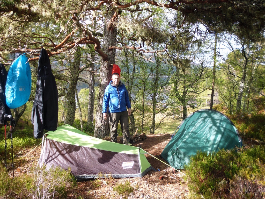
We found a promising looking outcrop of land jutting out into the loch which was both shaded by some large pine trees but also gave spectacular views back out eastwards along the loch. Hastily we pitched our tents under the shelter of the trees. With the heavy rain came swollen streams and there was an easy and plentiful supply of water near by to run through our water filter for drinking.
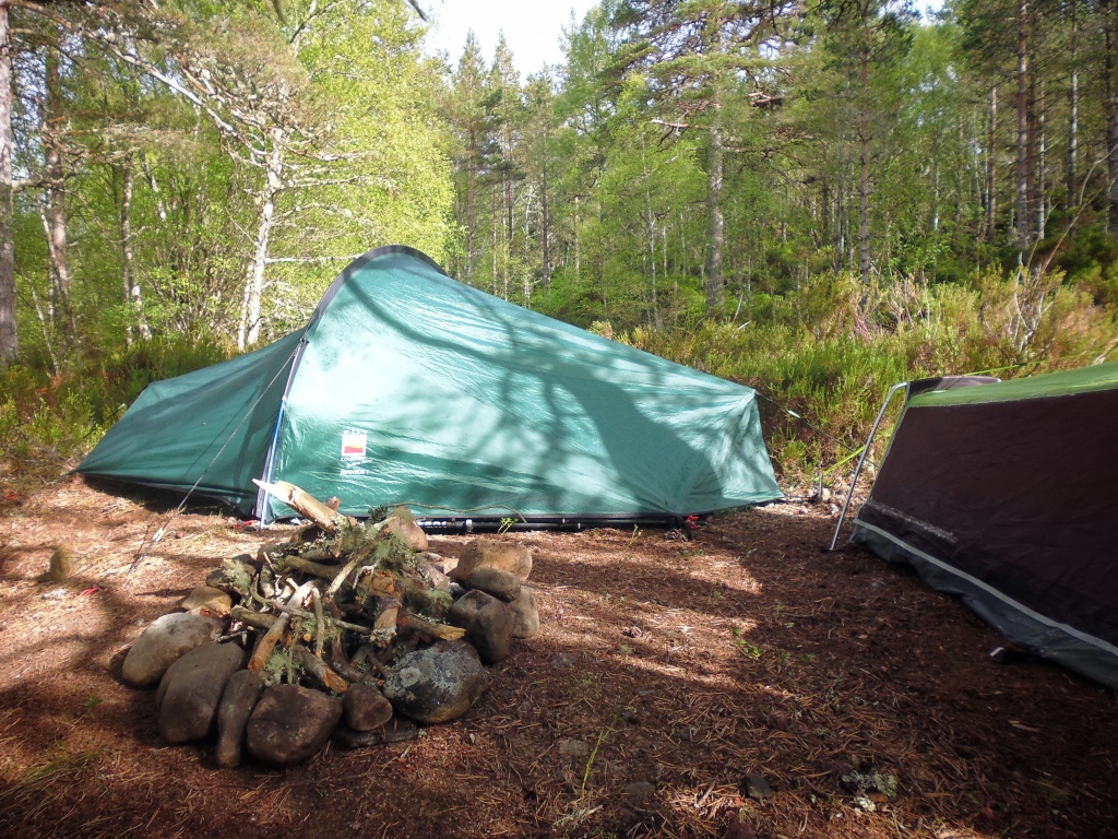
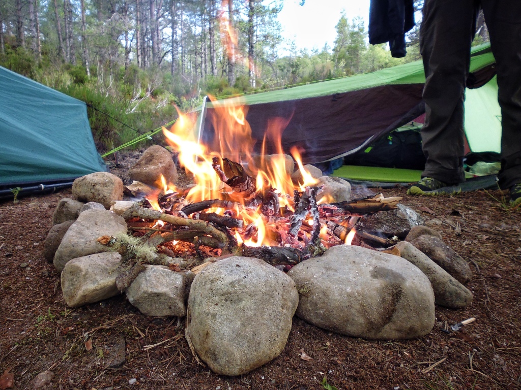
We made a fire hearth then comically and consistently failed to ignite any semblance of a fire. All those Bear Grylls episodes of Man vs Wild we had watched over the years had obviously not rubbed off on us and our lack of backcountry skills were laid painfully bare. Finally after countless attempts we succumbed to lighting a gas cylinder on the Jetboil and used it as a makeshift flamethrower directed at the twigs. Eventually we were at last able to sit next to a roaring fire and keep warm just as the rain dissipated.
The storm swept out almost as quickly as it had arrived and still air once again returned in its place, but with this new front came an appearance of midges all intent to feast on us relentlessly! We were systematically eaten alive for the remainder of the evening, both bitten and swollen we retreated into our tents for the night.
Affric-Kintail Way – Stage 3: River Affric to Alltbeithe – 8.4 miles/13.5km
Stage 3 of the Affric Kintail Way extends from the River Affric car park (which was a few miles further on than we had made it to the previous night) to the SYHA Glen Affric Hostel at Alltbeithe. This SYH is reputedly the most remote hostel in Scotland and we were hoping to stay there for the next night.
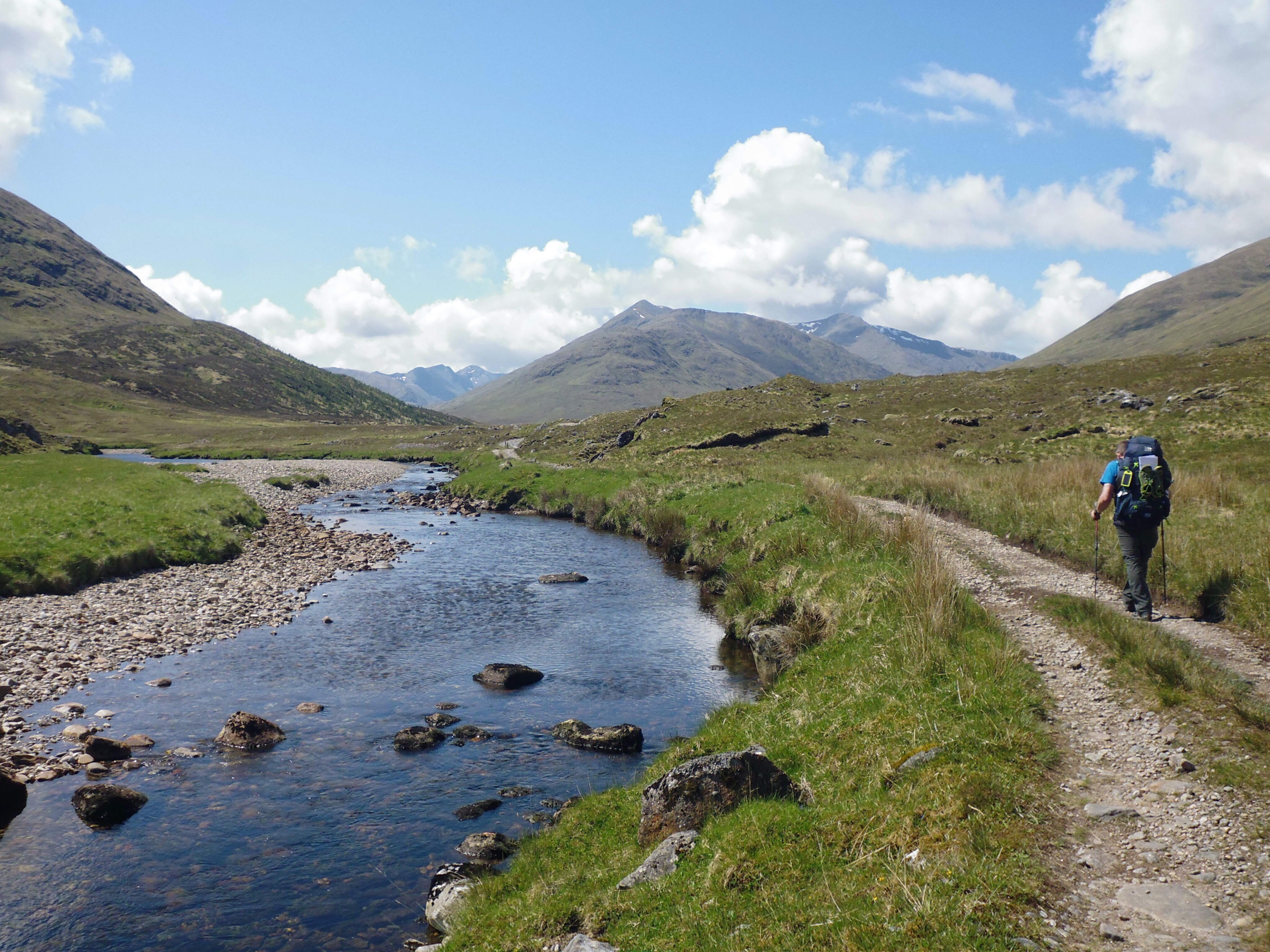
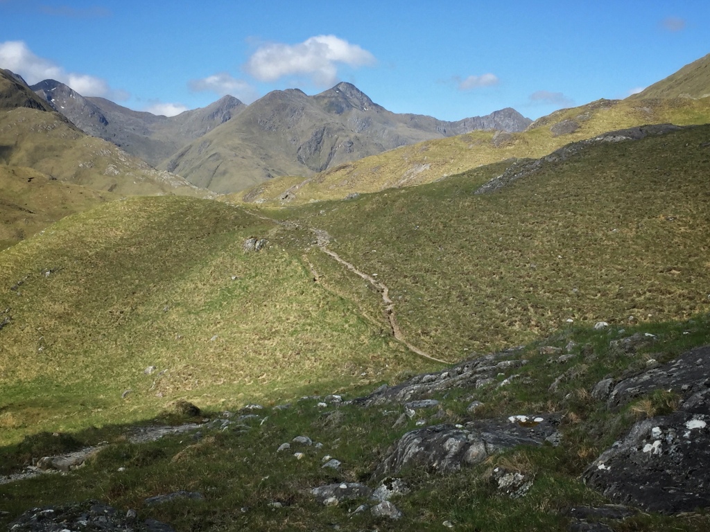
We were up early but once again so were the midges! They continued to feast on our flesh as we grappled to dismantle our tents. We would be travelling along the shores of Loch Affric on this day 3 with what promised to be a change in landscape away from the forests of the lower lands and the start of our ascent up into the wilder and sparser highland landscapes further along the glen.
We finished off the remaining distance along the shores of Loch Beinn a’ Mheadhoin that we had failed to make the day before and passed by the narrow waters between Loch Beinn a’ Mheadhoin and Loch Affric.
A further mile along and we were able to see Affric Lodge below and the accompanying views of the majestic mountain scenery beyond. Sgurr na Lapaich and An Tudair, plus the twin peaks of Carn Eige and Mam Sodhail all in the distance. The footpath gave great views out over the loch with the scenery opening up all the time as we moved along it.
Soon the mountains of Kintail came into view as we headed towards the old settlement at Athnamulloch. Evidently the last family to live here left sometime in the 1950s although cattle was still being brought to graze here for another couple of decades afterwards. The route then crossed the River Affric by the small wooden bridge at Strawberry Cottage. This small cottage is still owned by the An Teallach Mountaineering Club and can be hired throughout the year to access the nearby mountains.
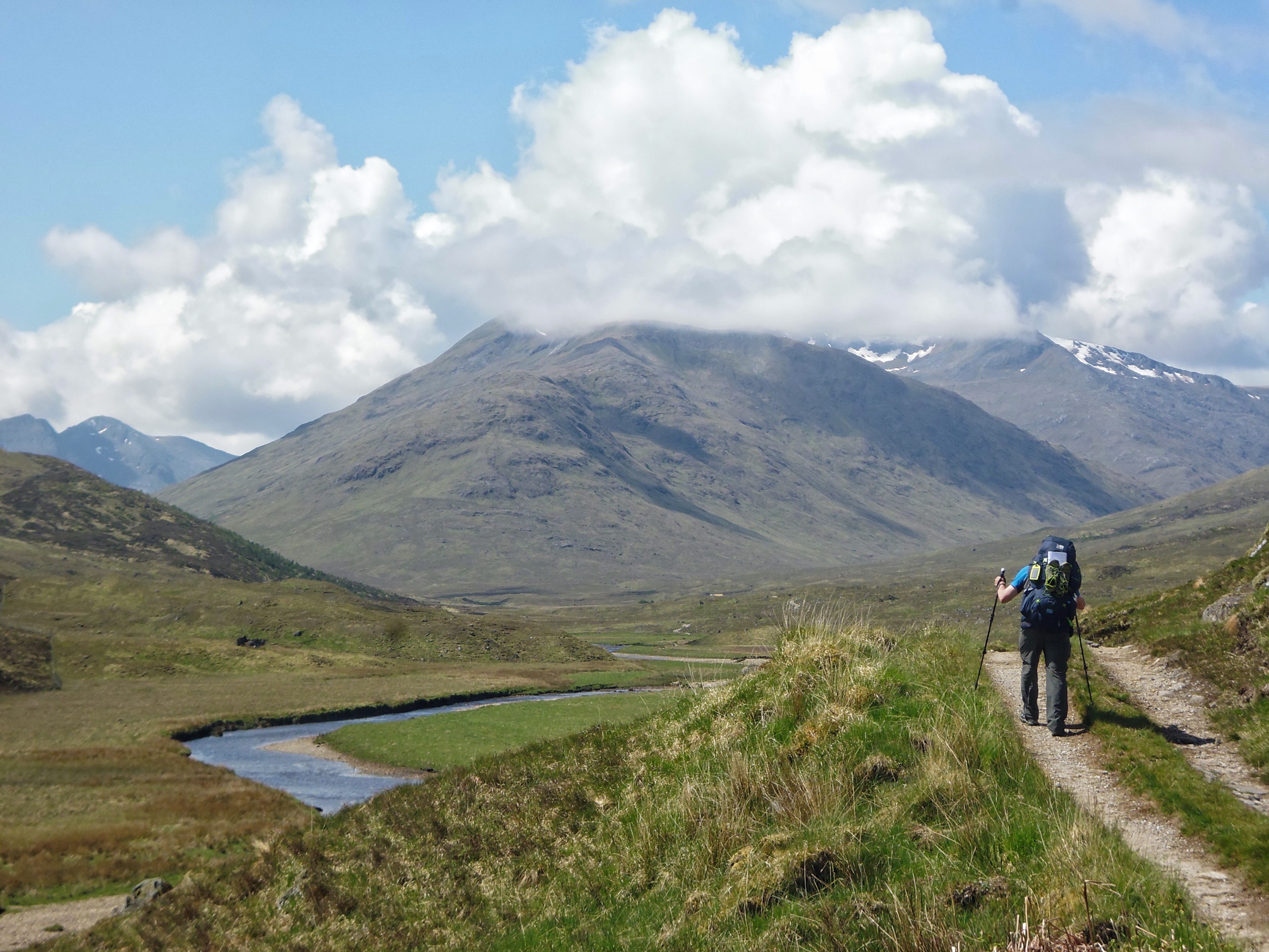
The path became more rugged and the glen began to reveal itself to us the further we trod. The weather was mild for Scotland and we plodded happily onward. We followed the River Affric up the glen as the single-track path we were on hugged the banks of the meandering river. We passed a number of old ruins along the sides of the path presumably from times past when the glen must have been more densely populated.
The tiny sheet-clad hostel at Altbeithe could not come into sight soon enough, for the three days of continuous hiking with our heavy rucksack had began to take its toll on out feet. We were now both tired and blistered. Steadily the silhouette of this small distant building grew in size as we neared it. A few minutes later and we both collapsed through the door of the hostel. There was room at the Inn, and we commandeered a room for ourselves for the night.
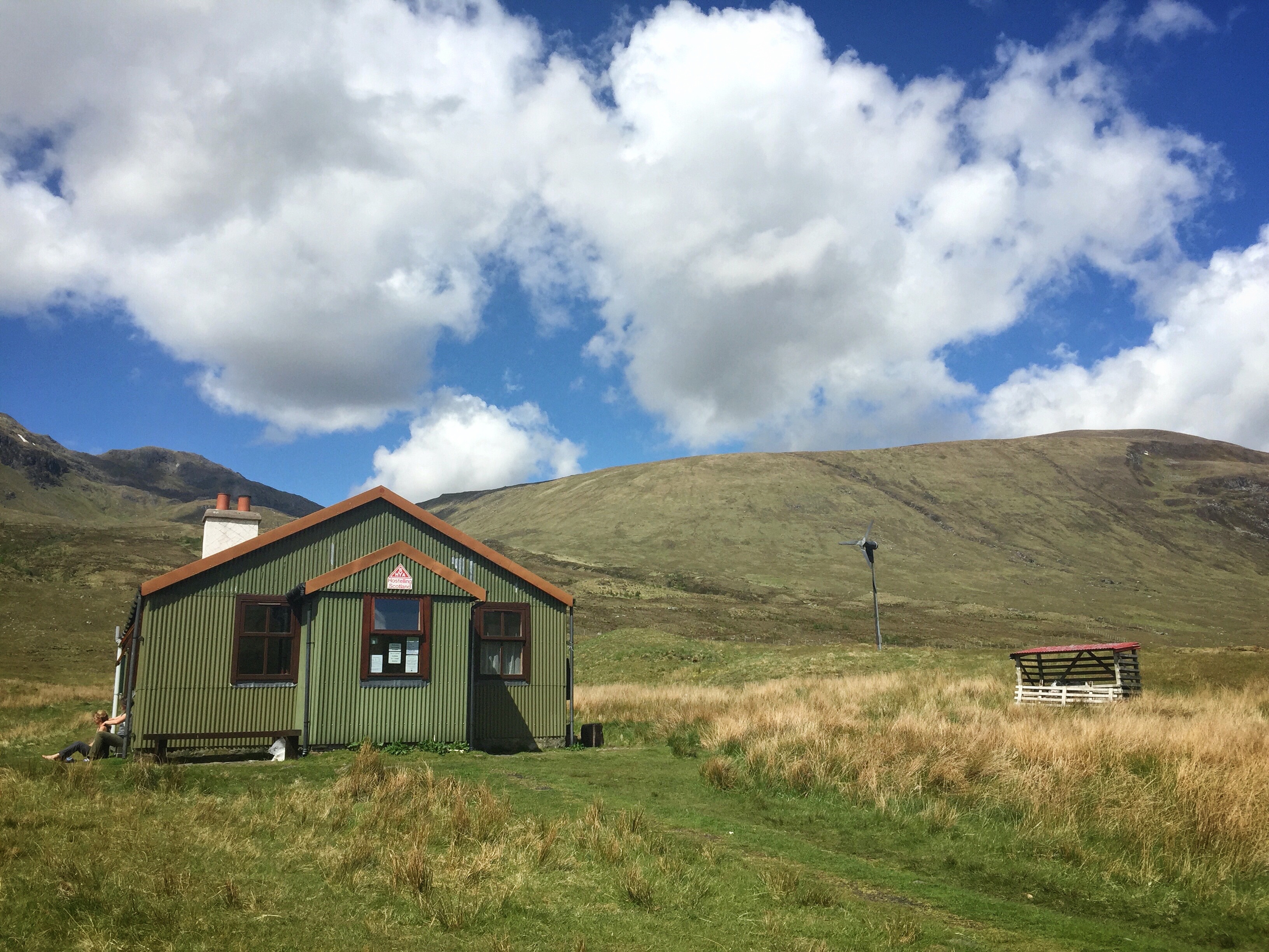
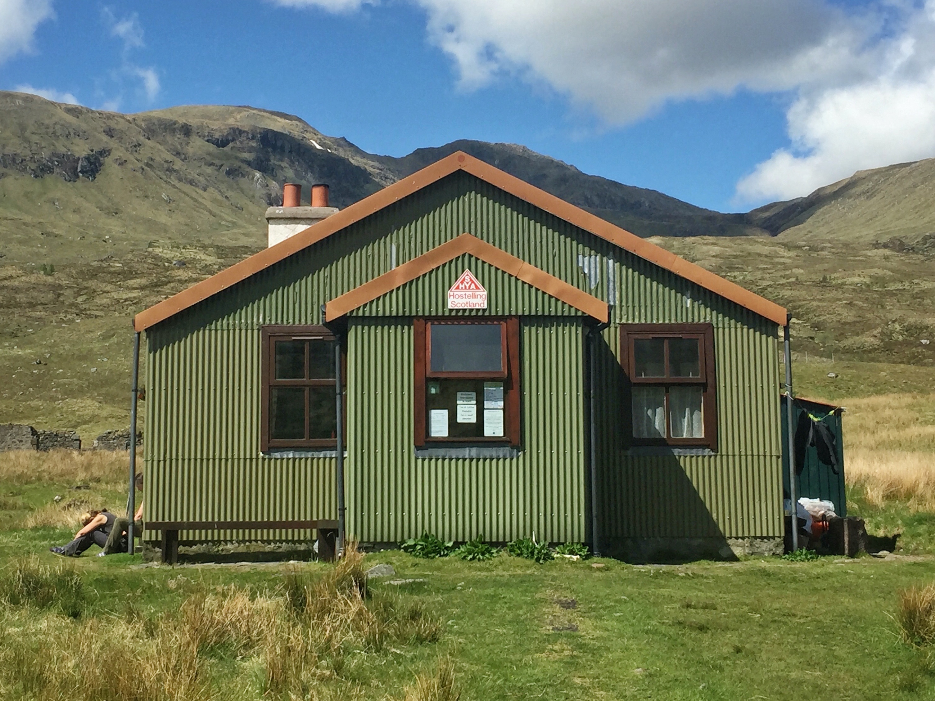
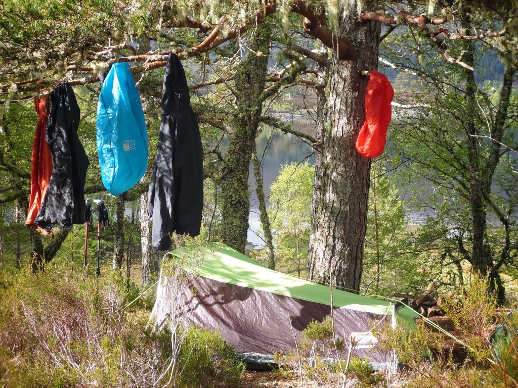
Glen Affric Youth Hostel is both unique and remote. A former stalking bothy on the Affric Estate it offers an unforgettable experience in one of the most beautiful glens in Scotland. A wind turbine and solar panels provide warm water and electricity, while the basic common room and kitchen are both heated by wood and coal fires. We raided the small hostel shop which sold soft drinks, juices, chocolate bars and crisps. There was no WiFi or mobile phone reception at the hostel so we were truly off-grid! Pure bliss!
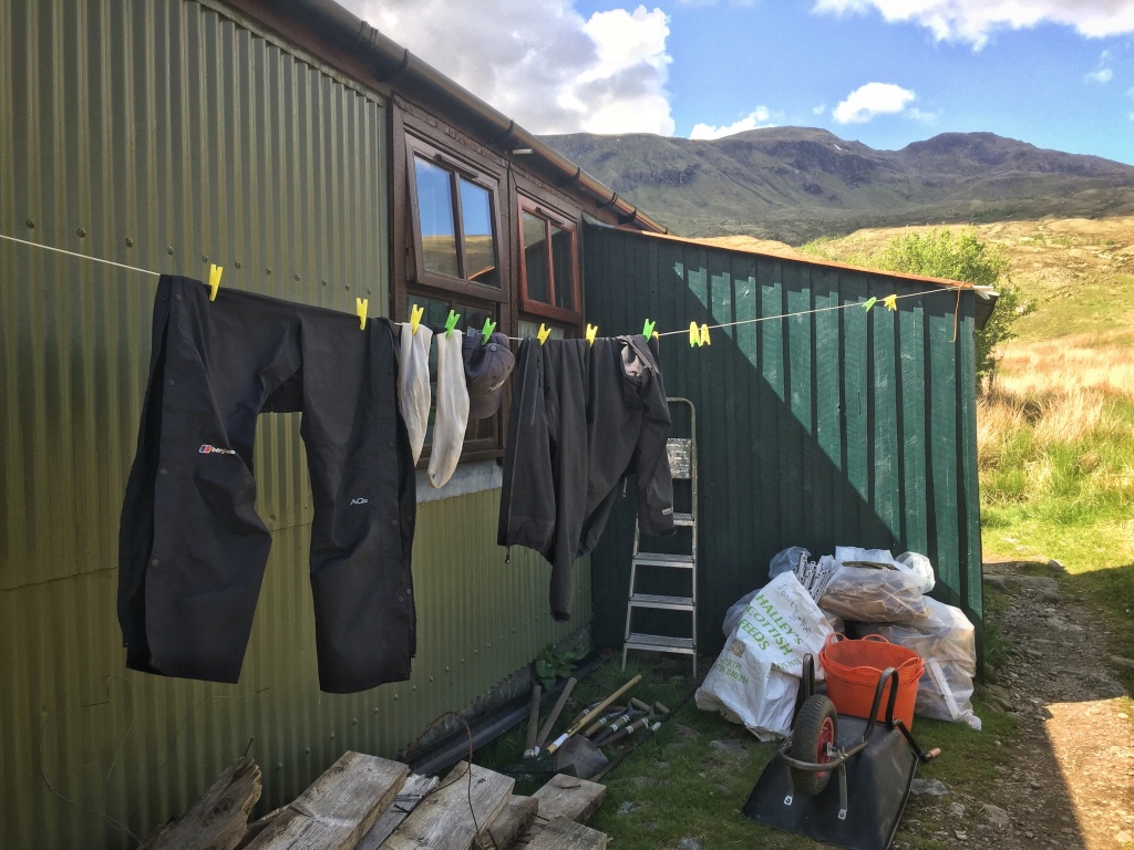
We hung various dirty and sweaty clothes outside in the Scottish wind to dry and sat down in the communal eating area to prepare our evening meal before hitting the sack in a blissful and comatose state of tiredness.
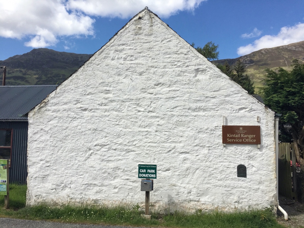
Affric-Kintail Way – Stage 4: Alltbeithe to Morvich – 11 miles/15.7km
After a leisurely breakfast in the hostel we sadly had to say our farewells to the other hikers and the guardians who had all welcomed us with open arms and who’s hospitality had been exceptional before setting out for the last time onto the trail. Stage 4 and the final stage of the Affric Kintail Way takes you from the SYHA Glen Affric Hostel to the NTS Ranger Station at Morvich.
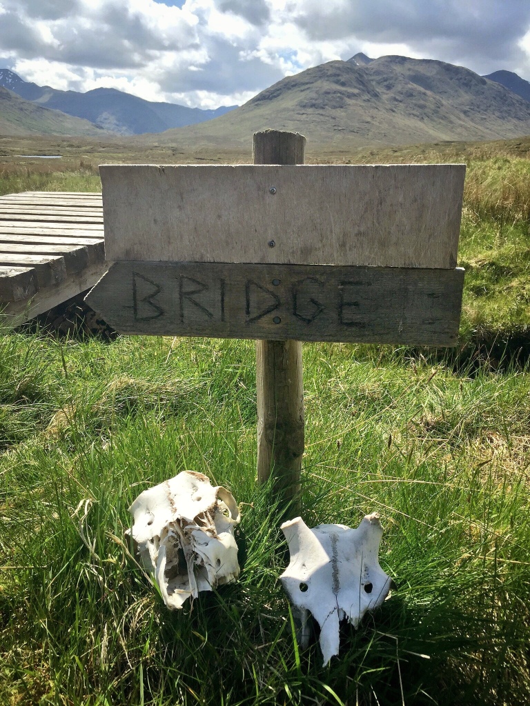
From the hostel we followed the path westwards crossing the Allt Gleann Gniomhaidh by a footbridge resplendent with some rather scary looking animal skulls and headed into Fionngleann.
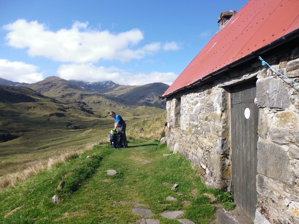
Before too long the Camban Bothy owned by the Mountain Bothies Association, came into view. This atmospheric bothy could be used as an alternative to the SYHA if you are unable to get in to the hostel and although cold and drafty it offers a dry night by candlelight in a most amazing setting. All you need is a nice wee dram a box of matches and you are all set up for the night!

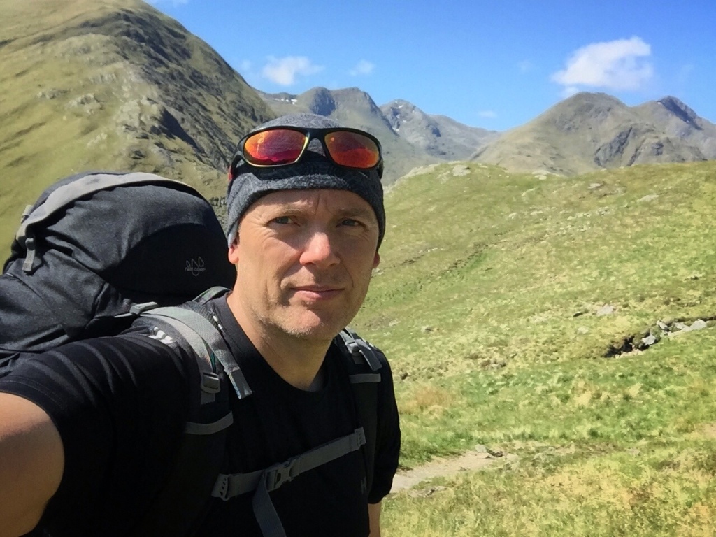
Leaving the bothy behind we gradually gained height as we trekked along the route further up and into the glen, all our aches and pains now forgotten as the end of the trip drew near. We were full of the joys of knowing that we were close to completing our little odyssey.

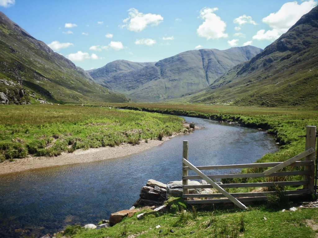
The track crossed a number of small streams tumbling down from the steep slopes of Beinn Fhada before we came across some small waterfalls that we passed by on a steeper section above the Allt Grannda. The path beyond now started to descend and before long we reached Gleann Lichd and the River Croe crossing over two small wooden bridges along the way.
As we walked along the glen we were flanked on one side by the mighty Beinn Fhada and on the other side by the Five Sisters of Kintail, a more spectacular scene you would be hard pushed to find. This is what we had really come all this way for, to see the magnificent highland mountains and glens of Western Scotland.
Our spirits were high as we continued along Gleann Lichd staying close to the meandering river. This was the payoff for all those countless miles walked, the pain and suffering along the way, the exposure to the elements and the whole roughing it. But then all too soon we happened upon a small wooden gate.
The gate led out of the glen and onto a public road near to the Kintail Outdoor Centre and it heralded a sudden return to civilisation. A further short walk along the road took us to the official end of the trail at the NTS Kintail Ranger Station.
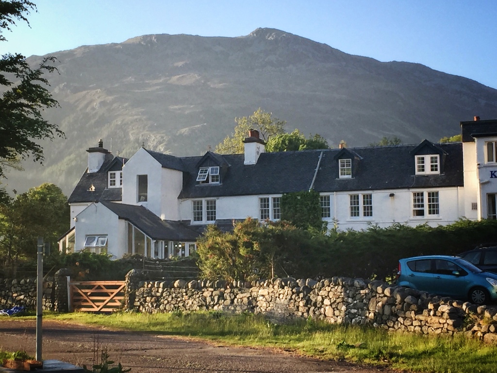
And that was it, we had finished The Affric-Kintail Way, 44 miles across the Scottish hills and glens. All that remained to do now was to walk the small distance to the shores of Loch Duich on the western seaboard where we had booked in advance into The Kintail Lodge Hotel with its well stocked bar of Whisky.
In the comfort of the hotel bar we sipped a dram and kicked back to relax and reminisce. The journey had in all honesty been a bit of a mixture of both some spectacular scenery and peaceful campsites but also a lot of mundane sections where trudging along wide forest roads with minimal views had somewhat soured the experience.
Would I do this long distance route again? Probably not for once is enough I feel, but that’s not to say it was wasn’t any fun. It stretched both myself and my brother-in-law physically by carrying the 60 litre rucksacks with all the camping gear and food on our backs for the four days plus it put us both outside our normal comfort zones, which is always a good thing.
There were some very nice camping spots along the way, the wild-camp was good fun (leave no-trace), the SYH at Altbeithe was both spectacular as advertised and very remote, in fact I wish I could have stayed there for longer. And when the mountain scenery did finally arrive it was truly spectacular. But the long sections in often dense forestry commission land, plus the odd sections on tarmac did occasionally spoil the wilderness feel for me so do please bare that in mind if you do ever fancy doing this LDT.
All the GPX files that I recorded along the route and links to the campsites and hotels that we stayed at are consolidated below for ease of planning for anyone who cares to. And if you do decide to have a bash at this hike please remember to Take Only Memories, and Leave Only Footprints.
GPX files:
http://www.shareyouradventure.com/map/66845/jamehand/The-AffricKintail-Way
Campsites:
http://www.borlum.co.uk/Camping/Campsite.html
http://www.highlandcamping.co.uk/index.html
SYHA:
https://www.hostellingscotland.org.uk/hostels/glen-affric
Hotels:
http://kintaillodgehotel.co.uk
