

‘Dead Woman’s Pass’ hardly an appealing name is it! Not the kind of name that lends itself to a good nights sleep prior to tackling it either. But here we were after a very disturbed night ready to attempt the highest pass on The Inca Trail. The nagging twin thoughts of would we be able to make it over the pass without succumbing to altitude sickness and why the hell was it called ‘Dead Woman’s Pass’ in the first place were probably foremost in most people’s minds as we trudged out of camp that morning.
After a bit of research this was the best I could come up with for the name – Of all the notable features along the way, the most talked about is Dead Woman’s Pass (“Warmiwañusca” in the Quechua language). This naturally occurring feature is so named because, when seen from the valley below, its crests resemble the form of a woman’s supine body. What makes Dead Woman’s Pass so famous (or infamous) is its altitude, at 4,215m (13,828 ft) it’s the highest (and most dreaded) point of the Inca Trail, and nearly 1,800m (5,905 ft) higher than the altitude of Machu Picchu itself.
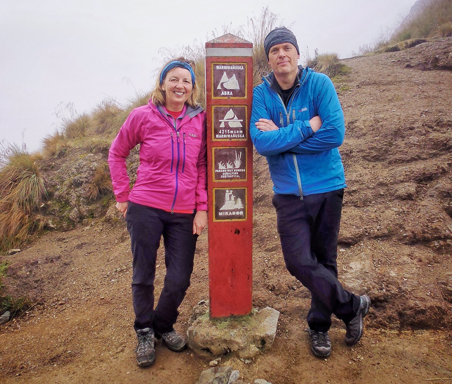
So it was with some trepidation that we trudged up the rocky path towards the ever looming col above. Onward and upward step after step, then suddenly we were there! No fanfare, no life affirming moment, just relief that from that point onward the trail (for now) at least was going to be downhill for a while. The pass was shrouded in mist as the clouds were yet to burn off and the views were restricted as a result and so it was that we sat and sweated profusely in a swirl of vaporous mist at the highest point of the trail. Thankfully there were no dead women in our group and so after a while to get our breaths back we started over again trekking along the trail.
The scenery becomes very mountainous on this part of the trail due to the altitude and the weather markedly cooler. We descended towards the campsite used by most trekking groups at Pacamayo (3,500m). Here we paused to drink some much needed fluids and donned our waterproofs for the first time on the trek as the heavens began to open above us.
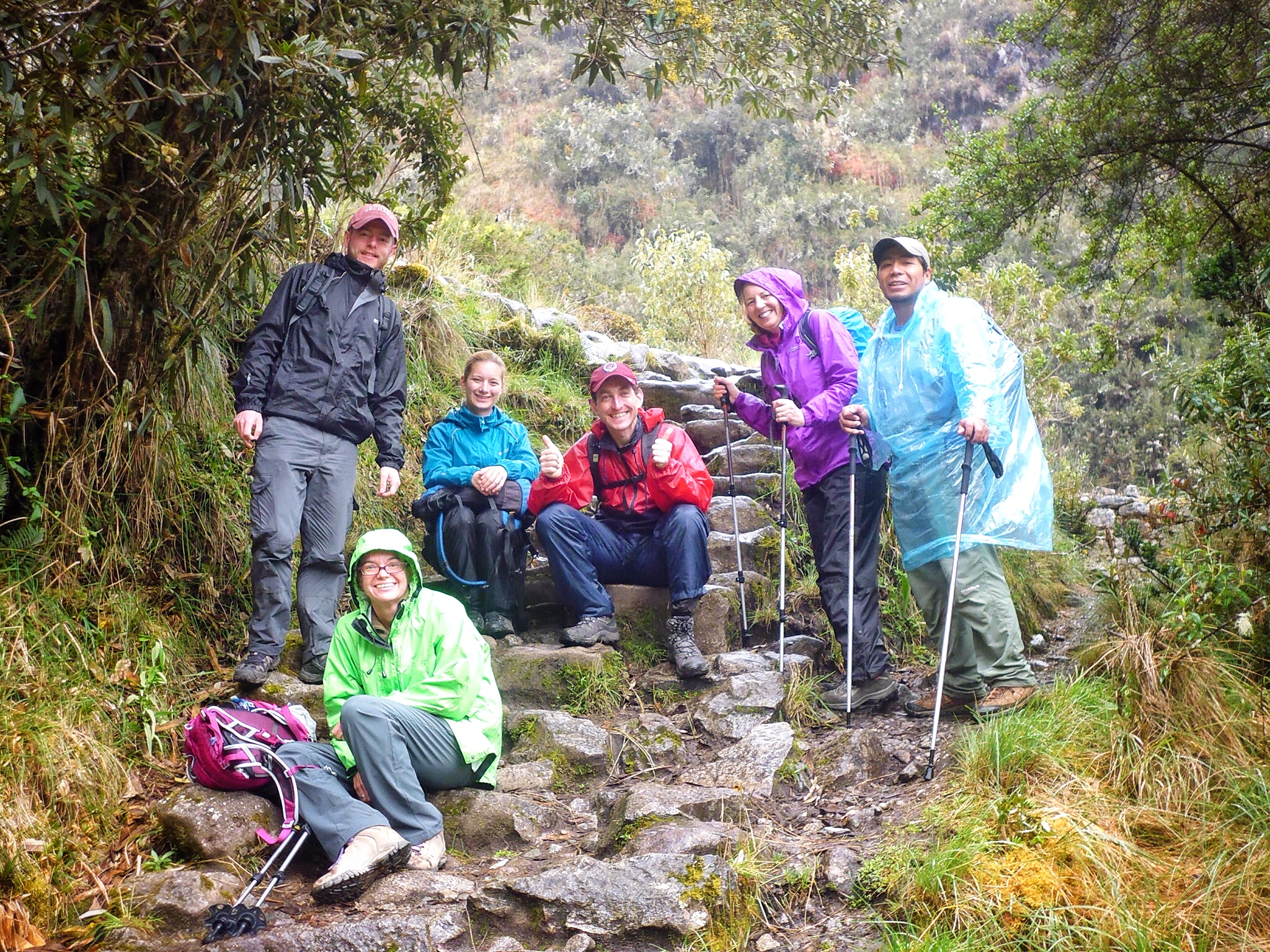
Now trekking upwards again we headed for the second pass of the day Runkuracay which is at another eye watering height of (3,950m). We paused at the old ruined fort which guards the pass at Runkuracay as the rain poured down upon us. Although our guide gave us an informative talk about the old fort all anyone wanted to do at this point was move on as we were now drenched through to the bone.
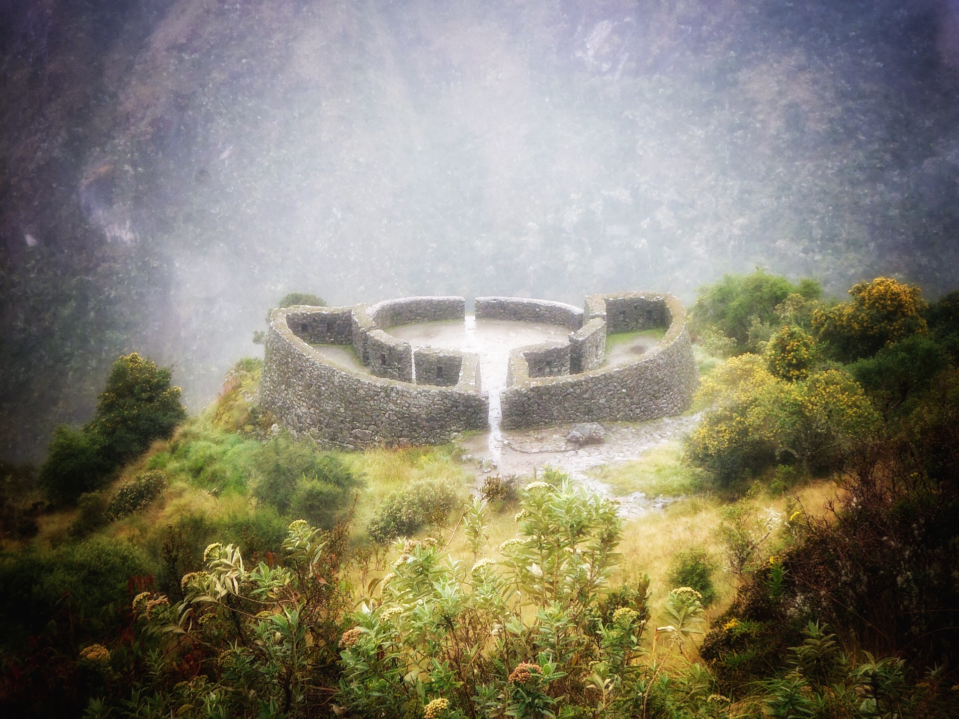
Upwards and onwards we trudged through the rain, this section of the trail up until the 3rd pass is particularly beautiful as the path crosses high stone embankments and skirts deep precipices. About one hour after the 2nd pass we arrived at Sayacmarca via a superbly designed stone staircase. The name Sayacmarca means ‘Inaccessible Town’ which describes the position of these ruins pretty perfectly, the town is protected on three sides by sheer cliffs. No one knows the exact purpose of these ruins but they are magnificent.
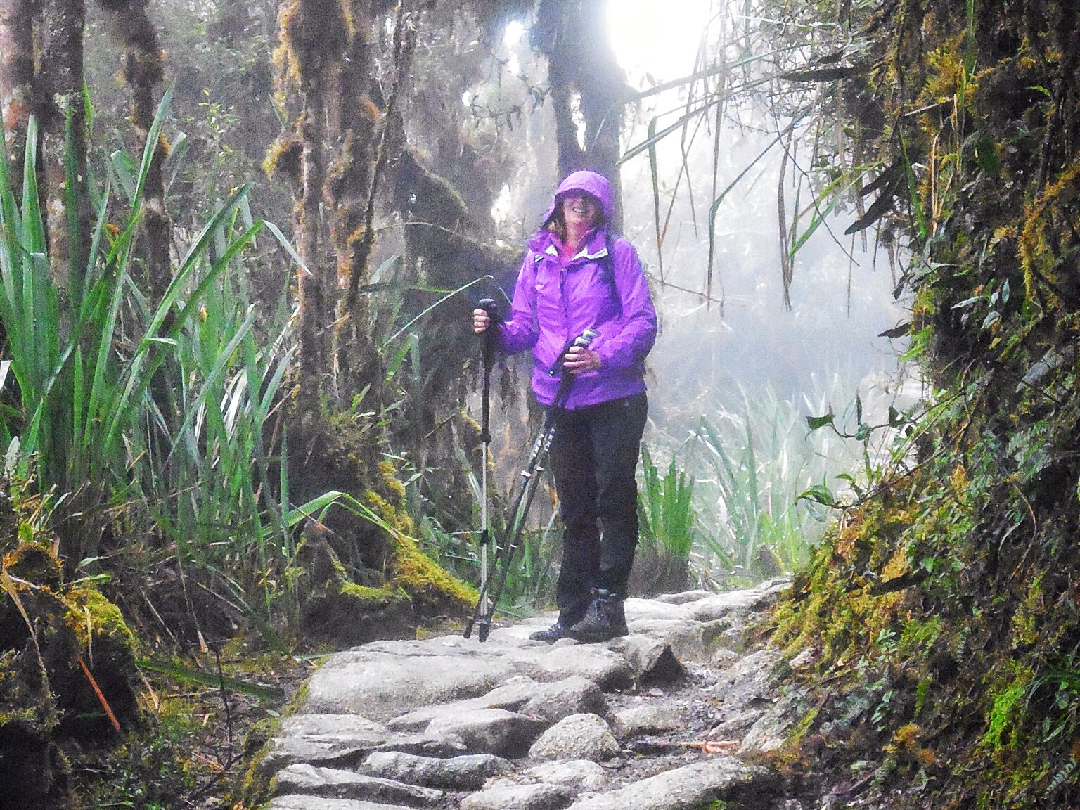
From here the path descends into beautiful cloud forests full of orchids, hanging mosses, tree ferns and flowers before passing through the famous Inca tunnel, carved into the sheer rock.
Here we came across a group of Americans floundering in the wet, steep and slimy stones in the tunnel. We offered our assistance but they insisted they were OK weighed down as they were with way too much gear for such a trek. They looked geared up to tackle a Himalayan Peak and it was probably all way overboard for a trek such as this.
Later, (much later) we would see their head torches flicker along the twisting trail in the night sky as they wandered into camp hours behind everyone else split up as a group and totally bedraggled by the weather. It was a sorry sight! They received a round of whoops and applause from around the campsite in a way that only Americans can (sorry to my American friends but you understand where I’m coming from).
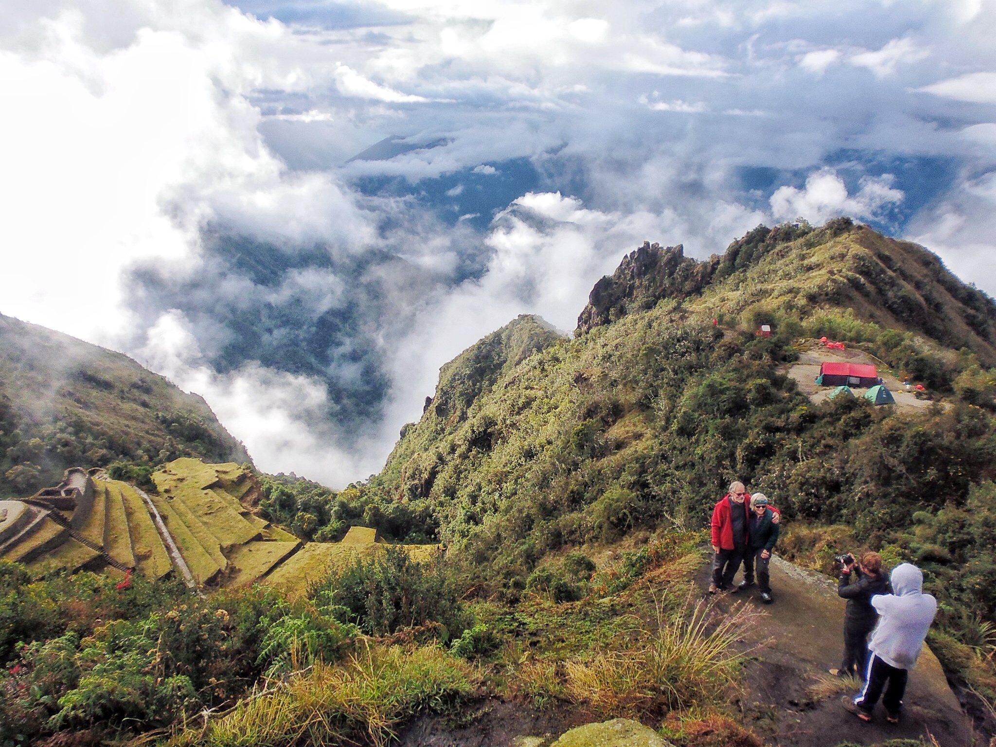
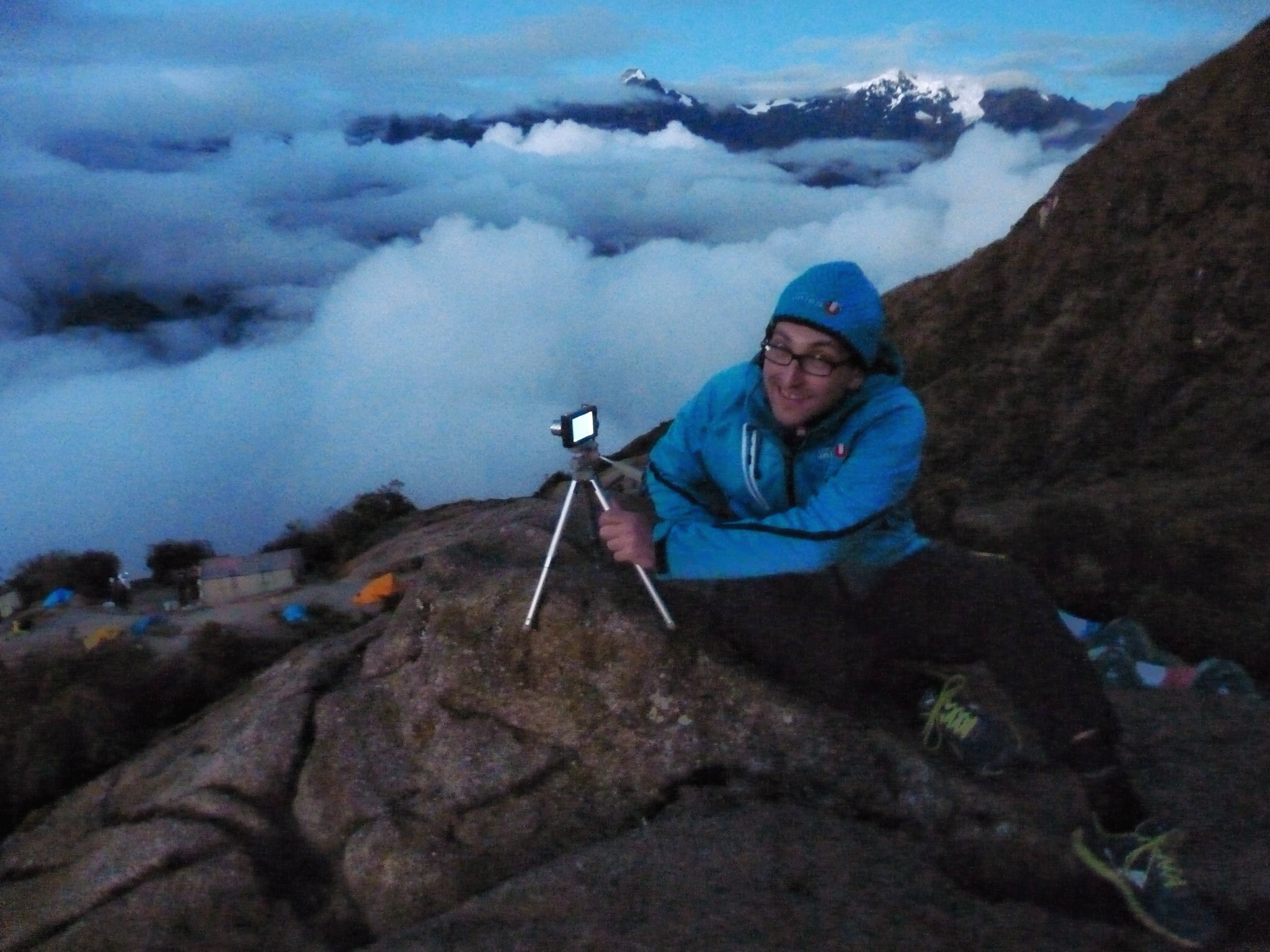
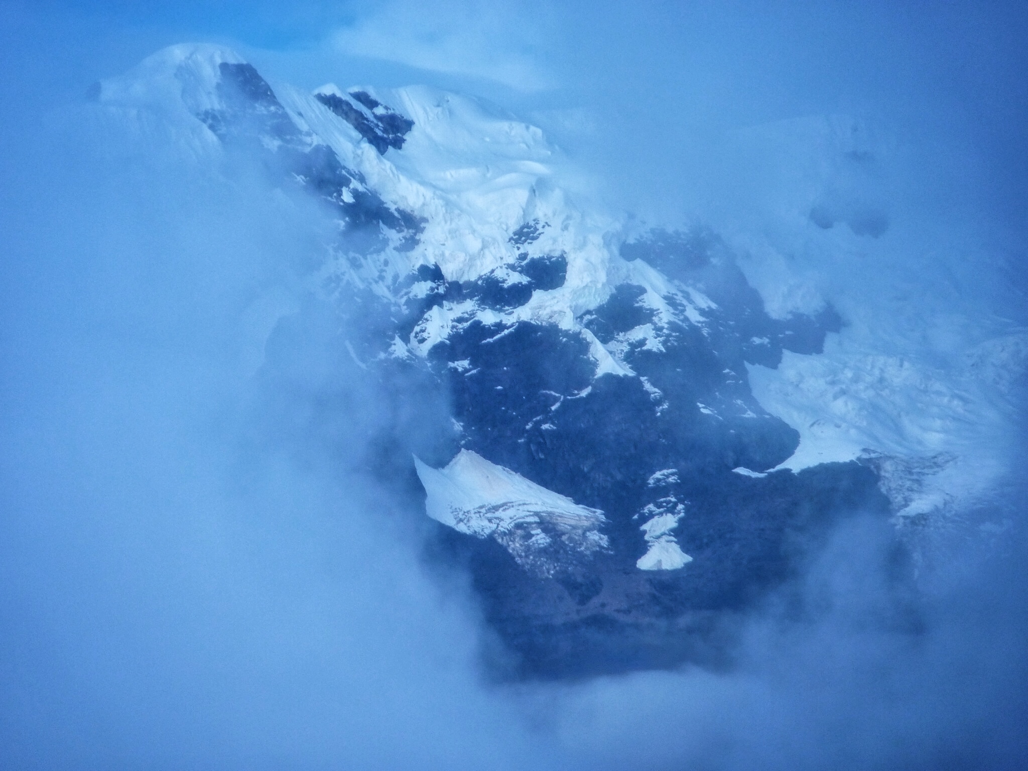
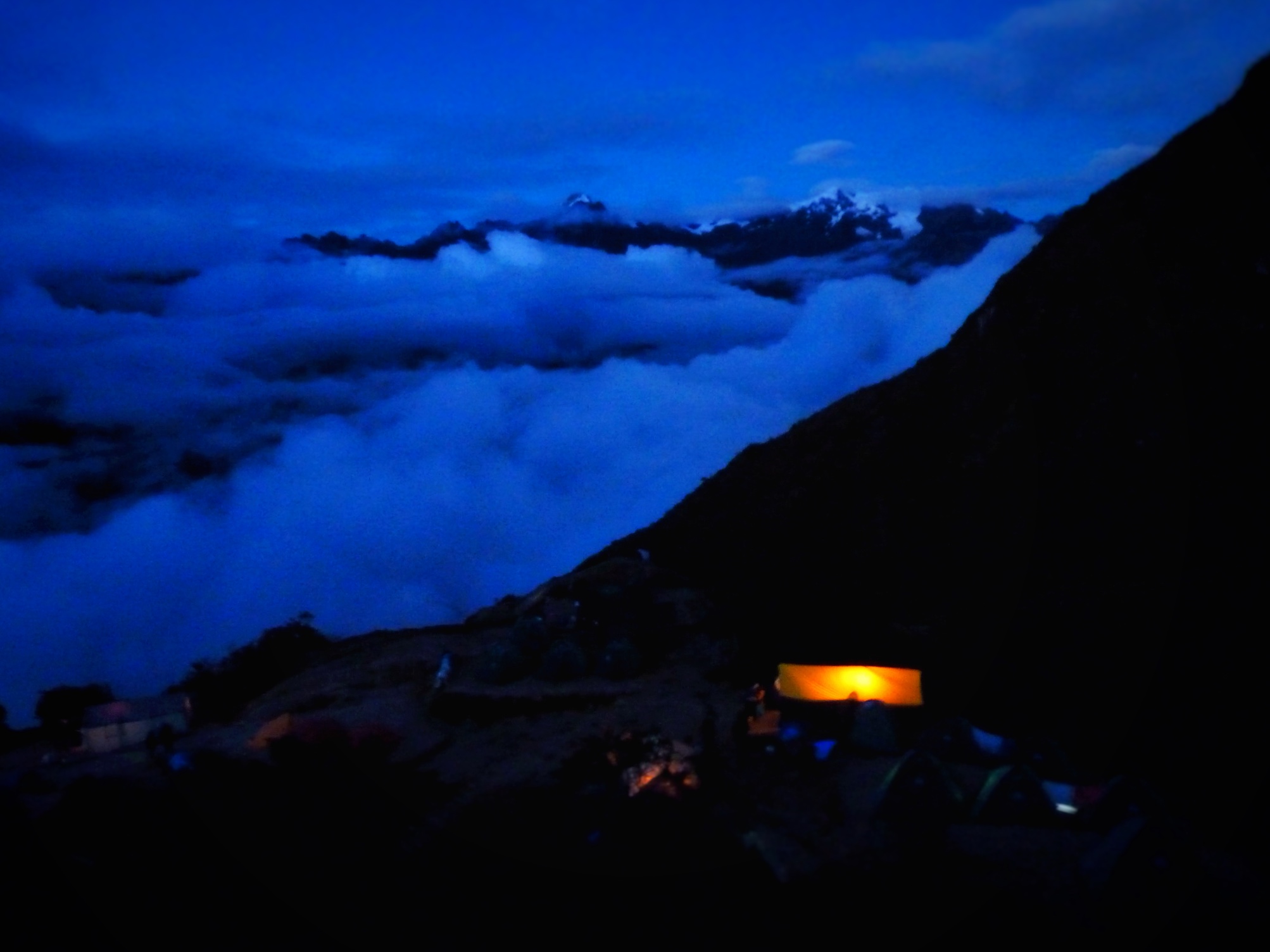
We climbed up to the 3rd pass (3,700m). The view from the pass (so I’m told) offers excellent views of several snow-capped peaks including Salkantay (6,271m) and Veronica (5,750m) but on a day like today with cloud and clag all views were obscured. A few more minutes after the pass are the ruins of Phuyupatamarca, and our campsite for the night. We would camp at (3,600m) our second highest camp on the trek. The name means ‘Town in the Clouds’ and it certainly lived up to it’s billing.
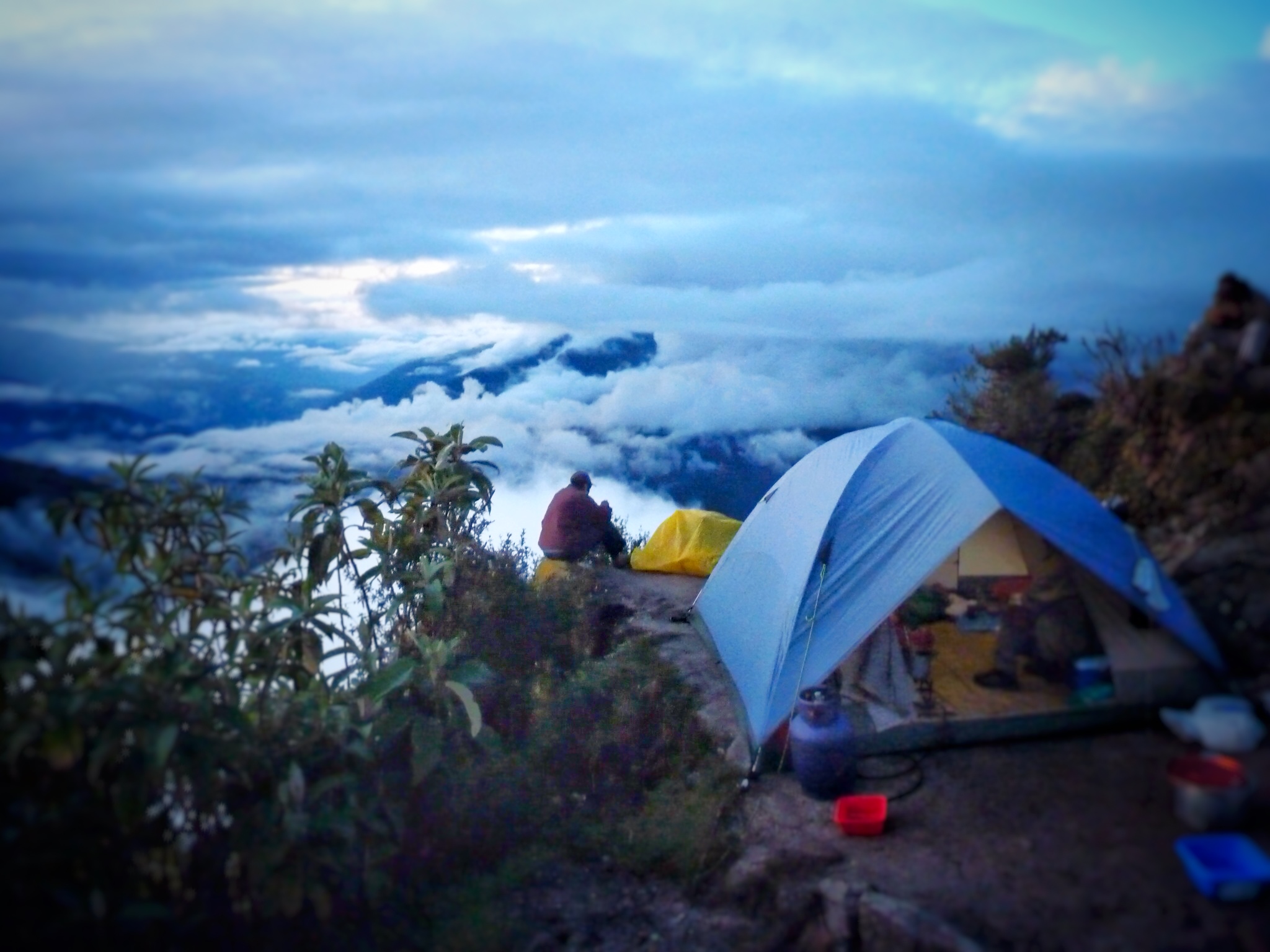
As night drew in and the clouds below us dissipated the surrounding mountains were gradually revealed to us and snow capped peaks could be glimpsed in the distance. This was a beautiful place to camp and I have never before or since spent a night under canvas in such an amazing setting.
We withdrew to bed that night a small band of very tired but also very contended and happy hikers. The days trekking had been challenging and magnificent but tomorrow offered even more, the big prize – Machu Picchu itself!
Next in this series of travel dispatches – The Inca Trail – Arrival at Machu Picchu


Pingback: What Nobody Tells You About Inca Trail Trips Until It's Too Late - spirtualglow.com