Foto Friday – The Laugavegur Trail

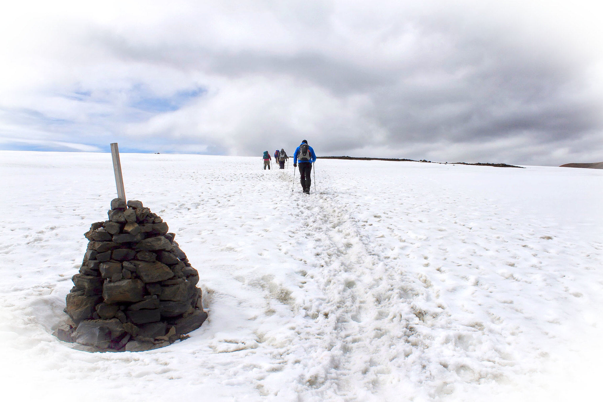
Following stone cairns for guidance I found myself trekking in a small team across a snowy plateaux in southern Iceland in 2013.

The whole team found the going to be way tougher than we’d expected for even though it was early July there was still a load of persistent deep snow left on the ground which made the going pretty hard.

The trek took five days to complete and took me from Landmannalaugar geothermal springs to the Þórsmörk nature reserve.

See more photography from the trek at www.jameshandlon.com/category/iceland/

Advertisement

The Laugavegur Icelandic Trek – Day 3

Álftavatn  Emstrur (Botnar)
Distance: 16 km | Estimated traveling time: 6-7 hours | Max Altitude: 608 m
Elevation change: 40m

After yesterday’s long haul, today promised to be rather more pleasant and easy in comparison. First off we would make our way across the Brattháls hills and then head eastward towards the Hvanngil gorge. Eventually we would cross the Bratthálskvísl river on foot (a much anticipated and feared prospect), then further on the Kaldaklofskvísl river would be crossed by bridge, and finally the Bláfjallakvísl would be forded again on foot. One thing was for sure we were going to get wet today! Continue reading “The Laugavegur Icelandic Trek – Day 3”