Ascent of Goatfell and North Goatfell – Isle of Arran

The Route: Goatfell and North Goatfell | Distance: 12.4km | Time: 4 Hrs
Height gain: 954m | Max Altitude: 874m
Start: Brodick Castle Grounds | Finish: Corrie
Map: OS Explorer OL361 | Date: 12/06/2012

Route Map

The clouds finally lifted after a week spent on the island and the high summits where finally revealed for the first time since landing ashore all those days ago. The opportunity had come at last – Summit Day!

I excitedly packed my rucksack before I’d even had time to consume my breakfast. The car door was quickly slammed shut and I drove south towards The Goatfell Range eager for some high adventure in Arran’s highest mountains. Continue reading “Ascent of Goatfell and North Goatfell – Isle of Arran”

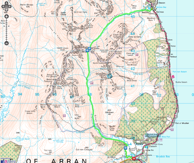
The Famous Saddle – Isle of Arran

The Route: Glen Sannox to Glen Rosa via The Saddle
Distance: 15.1km | Time: 4.5 Hrs
Height gain: 635m | Max Altitude: 423m | Start: Sannox Bay | Finish: Brodick
Map: OS Explorer OL361 | Date: 11/06/2012

Route Map

Oh the Saddle, well it’s easy really (well at least on one side anyway)! Well which side, I would ask? Oh the descent side son!

I’d heard this over and over again while on Arran and had become intrigued. The weather had been awful now for two days the low clouds, rain and clag hanging over the mountain like an illness obscuring any hope of a view of their spectacular summits. So it was that I decided rather than attempt a summit bid in the mist and rain I would instead hike along the classic Glen Sannox to Glen Rosa route and climb over the famous Saddle. Continue reading “The Famous Saddle – Isle of Arran”