The Nantlle Ridge – Snowdonia’s best Ridge Walk?

The Nantlle ridge is one of Snowdonia’s real hidden gems. Unbelievably, it is hardly known by most who travel to North Wales.

The seven mile long ridge offers some dramatic scenery. There are several tasty non-technical scrambles along the way. The best part is that you will probably have it to yourself!

The scrambling on this hike isn’t technical. The exposed elements of the ridges can be avoided. It’s also a perfect hike for those wanting an introduction into ridge walking.

  • Distance: approx 7 miles
  • Average Hike Duration: 4-7 hours
  • Elevation Gain: 930 m
  • Hike Difficulty: Moderate/Hard  
  • Hike type: Linear Route
  • Start Point: Rhyd Ddu
  • Finish point: Nebo
  • Technicality – Some minor scrambling and exposed ridge walking

If you have two cars, it is by far the best way to tackle the logistics. We hiked one way from east to west. We started from Rhyd Ddu. First, leave a car at the end point in Nebo.

We parked in a small grassy area next to Llyn Cwm Dulyn. From here, you must drive back 10 miles east in the other car. The drive takes around 25 minutes to reach Rhyd Ddu.

Rhyd Ddu to Y Garn

We parked just uphill from the crowded the station car park at a convenient spot then headed west on a well-made path. After that, we started ascending the rugged east ridge of Y Garn.

This section of the route is a hard sweaty slog uphill with a mixture of grass and stones underfoot.

There is no scrambling on this first section. The summit is soon gained at 633 m above sea level.

Y Garn to Mynydd Drws-y-Coed

From the summit of Y Garn, take the route south. Follow this path for around 1 km. The next summit is Mynydd Drws-y-Coed.

The left hand side of this ridge is exciting and also very steep in places. Spots along the way if you loiter offer some delightful and airy views down the valley.

There is some grade 1 scrambling over occasionally messy rocks around this section (very slippery when wet). The path through the jumbled rocks is also quite feint and can be hard to follow if in poor visibility.

Mynydd-Drws-y-Coed to Trum y Ddysgl

From Mynydd Drws-y-Coed, the path descends and veers off to the right in a westerly direction. Then the route rises steeply up to the second-highest summit on the Nantlle Ridge – Trum y Ddysgl.

The path here gets slightly steeper but is mainly on dirt and is well-trodden enough to be visible.

Trum y Ddysgl to Mynydd Tal y Mignedd

The next section of the Nantlle Ridge runs from the summit of Trum y Ddysgl. It takes you on another well-trodden path up to The Obelisk on the summit of Mynydd Tal y Mignedd.

The path along this section is clearly visible and causes no issues with navigation.

From the Obelisk to Craig Cwm Silyn

From the Obelisk, we headed south on a grassy ridge for around 400 m. Then, we went down a steeper path to the double col at Bwlch Dros Bern.

The path is quite steep here and care does need to be taken especially if it is raining as it would be slippy.

The route up to Craig Cwm Silyn is then laid out in front of you. The area just to the left of the ridge is quite exciting and provides scrambling at an easy grade 1.

Further towards the right, the path avoids much of this. Take this path if you are not quite feeling it or questioning your wisdom at this point.

Craig Cwm Silyn to Garnedd Goch

From Craig Cwm Silyn, we followed a broad grassy ridge. It was featureless and boring by comparison the the route so far. This led us onto the final summit of Garnedd Goch.

This section of the route is pretty featureless. On a bad day, it could cause some navigational issues. However, on a bright pleasant day like we had, it was just joyous hill-walking at its best.

At this point, we debated whether to tag on Mynydd Graig Goch. We decided for argument’s sake that it was not really part of the main ridge. It could be considered as stand alone.

As fatigue had started to dig in this meant that we could now happily call it a day. We began our descent towards the Llyn and the parked car.

Some Final Thoughts on The Nantlle Ridge

The views on this the quieter side of Snowdonia are stunning. Getting away from the crowds is always a bonus. There is hardly anyone on these hills just a stone’s throw from Snowdon.

As a hiking route, we both rated The Nantlle Ridge very highly. There are a few sections of easy grade 1 scrambling to be aware of. It has everything you could want on a day out in the hills.

You also get a bit of added spice from the scrambling if you want it. The only drawback is the logistics.

However, if you can get around that, this is a solid and highly recommended day outdoors. JUST DON’T TELL ANYONE ELSE!

Accomodation – Bwythyn Bach

There are lots of options of where to stay in Snowdonia but we opted for this small detached bunkhouse. It sits just up the road from the start of the route at The Cwellyn Arms Campsite.

With 2 bunk beds it is ideal for 2 persons. It has a shower and toilet, a small baby belling cooker with hob and oven/grill, for basic cooking requirements, small fridge, kettle, toaster and sink.

It also has a wood burning stove. It is basic to say the least, but in my opinion that just adds to the adventure of the trip to the Welsh Mountains should you decide to tackle The Nantlle Ridge!

The Kungsleden Trail: A Journey Through Sweden’s Wilderness

Twelve years ago I acquired a book entitled ‘The Kings Trail.’ It featured a description and photos of a wilderness in northern Europe. This place was still almost untouched and unheard of. In 2024, I finally got to go there! Full details about all the logistics involved and travel to and from at the bottom of the report.

The Kungsleden Day One.
On June 27th, 2024, my friend Dale and I began trekking in Abisko. This town is roughly 200km north of the Arctic Circle. Here we started the first day’s trek of many to come as we embarked on Stage 1 of The Kungsleden (Kings Trail).

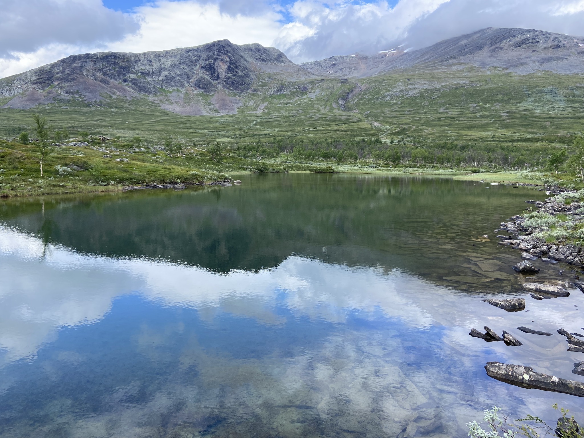
We experienced beautiful weather. The scenery was stunning as we followed the Abisko River down through the Abisko National Park. Finally, we reached Abiskojaure Fjällstugor, which is 14 km to the south.

Abiskojaure Fjällstugor. We camped at the fell station on our first night on The Kungsleden Trail. A beautiful spot on the edge of a lake. Secluded beach, forest camping, and some amazing log piles amongst the wooden cabins. An idyllic spot.

The Kungsleden Day Two.
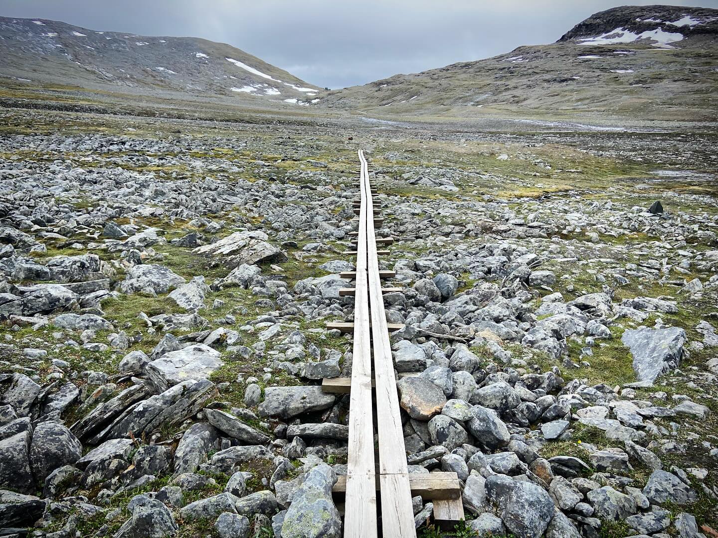
The long trek from Abiskojaure to Alesjaure of around 16km.

Beautiful weather and more amazing scenery as we followed the trail into the remoteness of the mountains.

A long and tiring walk followed the initial day. We were rewarded with expansive views across a valley filled with lakes. The evening offered us a beautiful wild camp by the lake shore.

The Kungsleden Day 3 .
Alesjaure to Tjäktja a hike of approximately 20km.

A tough day on the trail with a long distance to cover and persistent rain as company. The constant deluge resulted in several swollen rivers to cross.

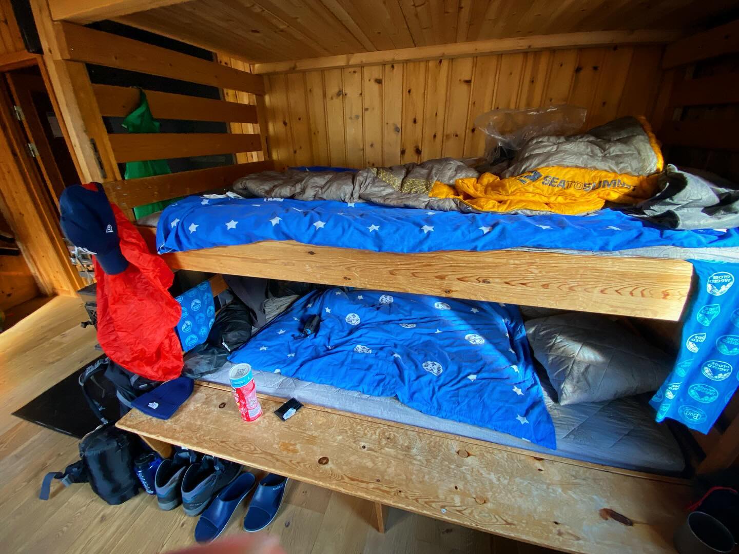
We eventually limped into the mountain station just short of Tjäktja pass happy to get a bunk for the night.

The Kungsleden Day 4.
Tjäktja to Salka approx 11km.

We ascended to the Tjäktja Pass which is at 1,150m above sea level and the highest point on the trail.

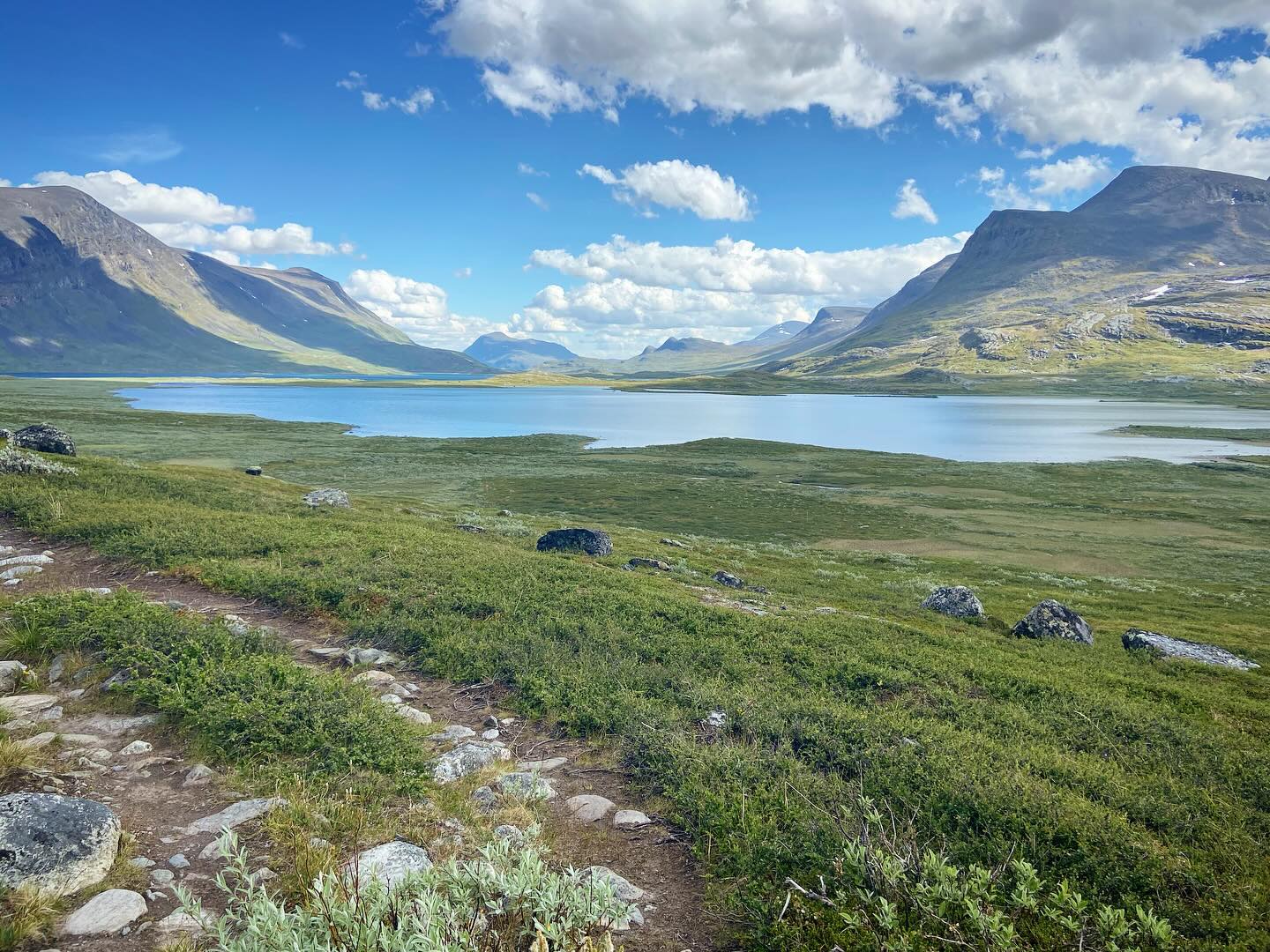
The weather was mean and moody. This added to the atmosphere as we entered the Tjäktjavagge valley for the first time.

This 30km long glacial valley is a magnificent thoroughfare through the Swedish mountains.

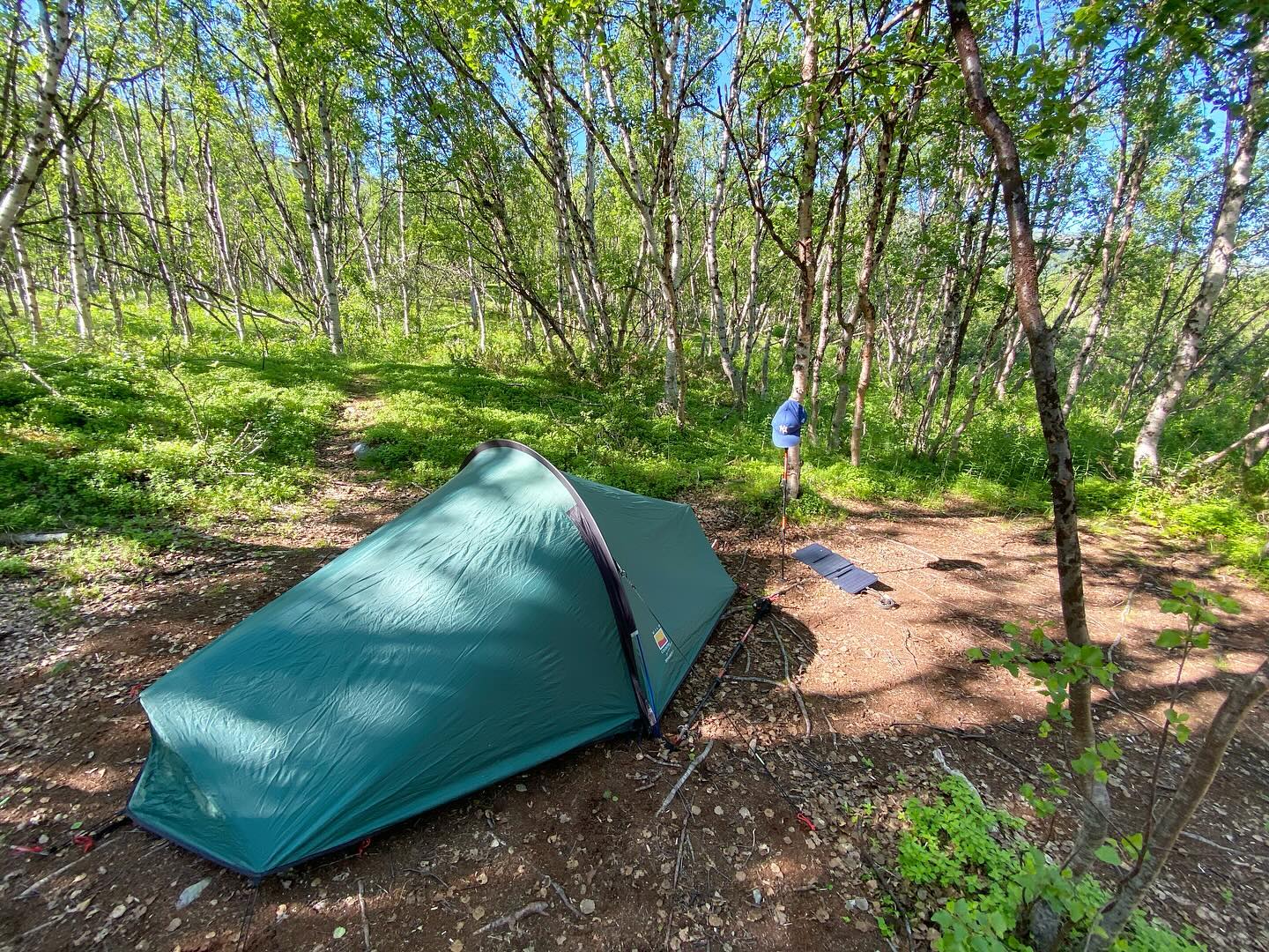
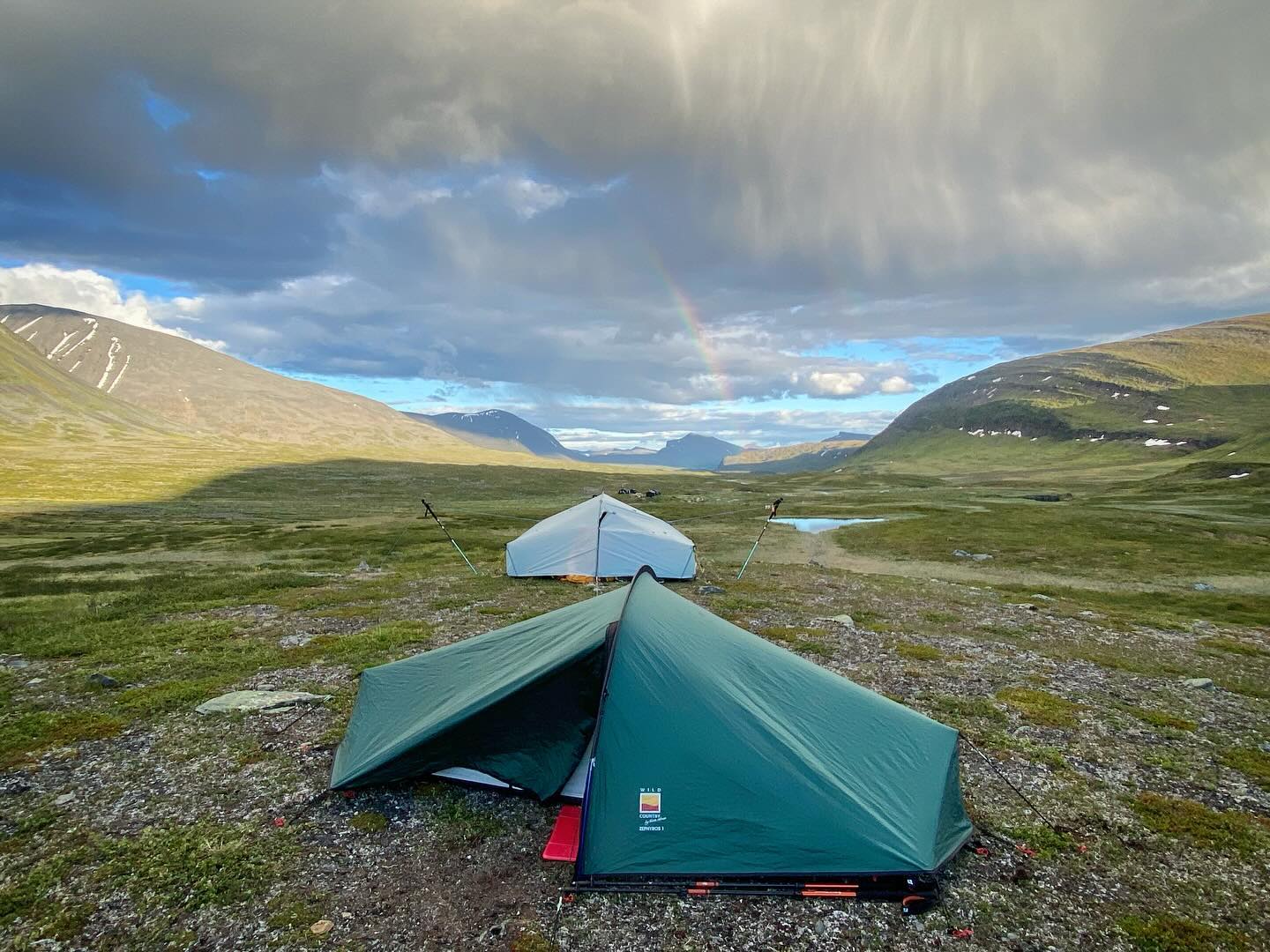
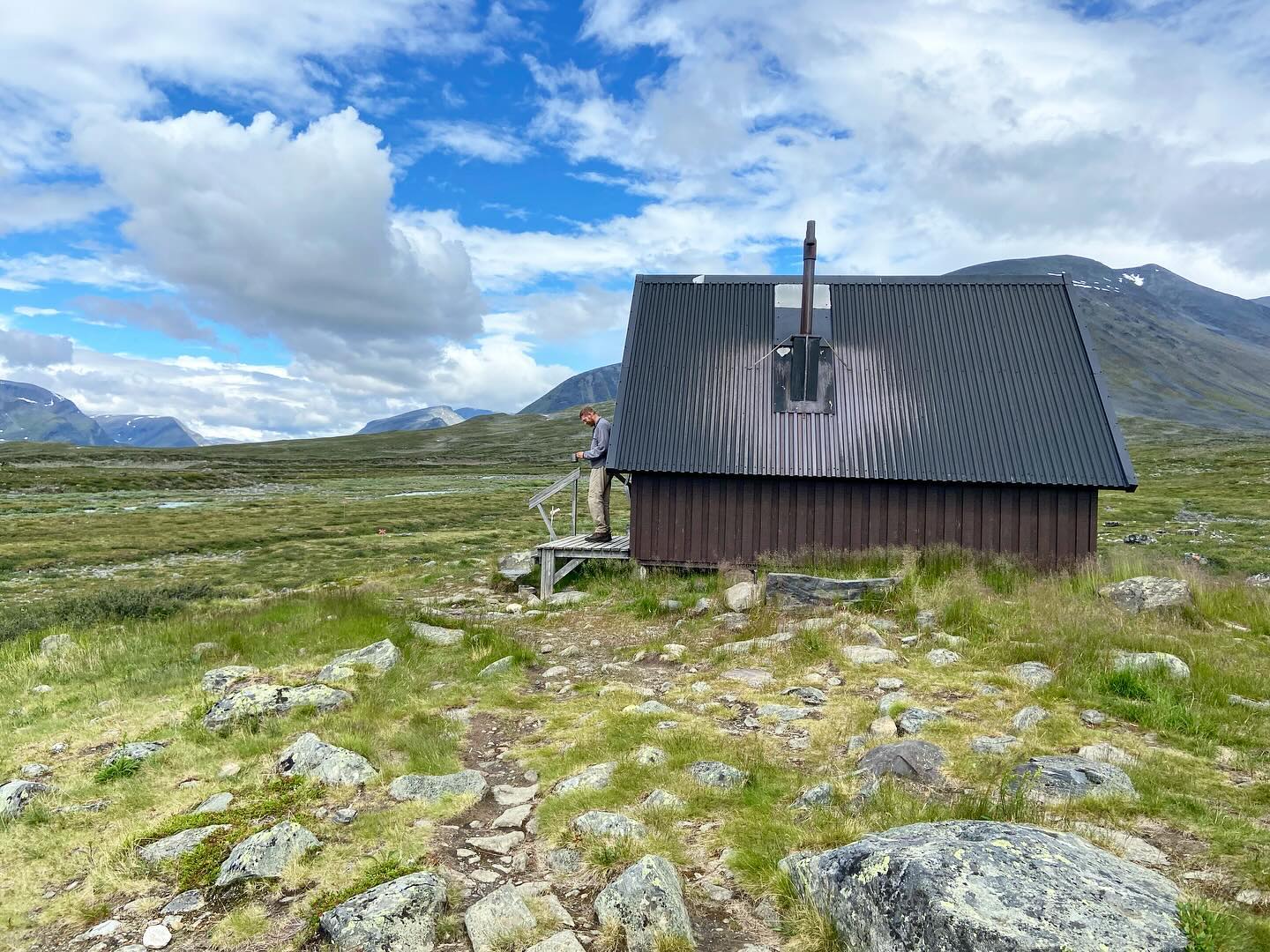
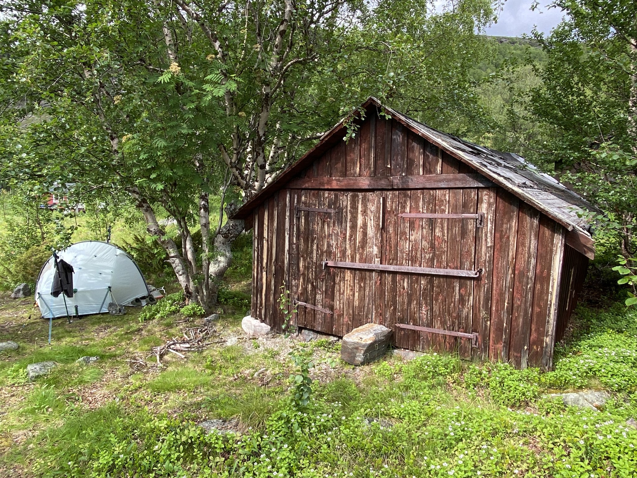
We decided to wild camp just short of the mountain hut at Salka. We camped atop a glacial moraine mound at the intersection of three valleys. A magnificent spot!

The Kungsleden Day 5 – Salka Wild Camp.

A chilly and remote camp at the head of several glacial valleys. Weather watching as the clouds roll up the valley and water filter duties down at the river. Waiting for the chance to climb a nearby peak in the morning.

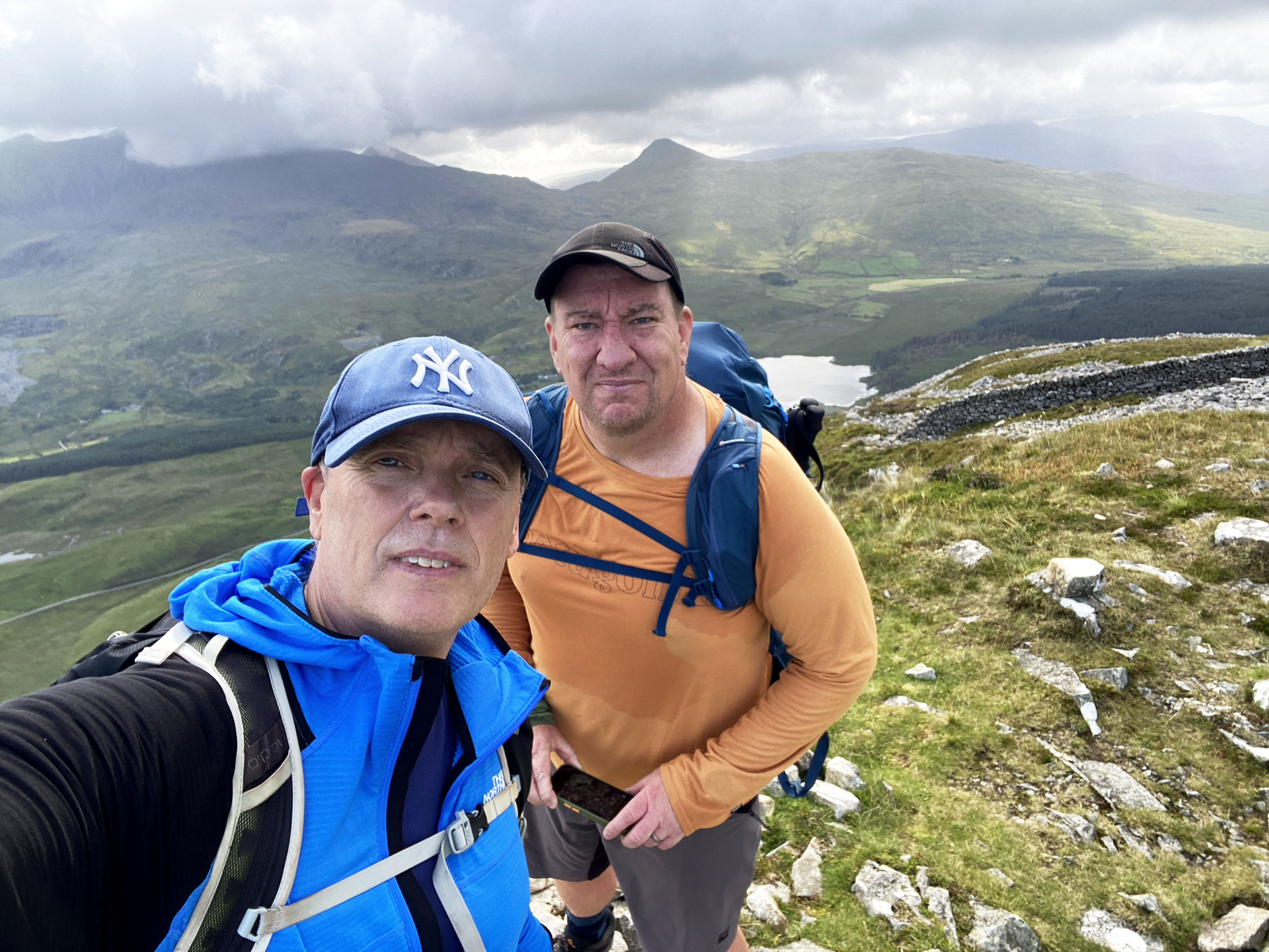
The Kungsleden – Mountain Day 1.
From our wild camp near to the Salka Mountain Cabins we launched ourselves into the nearby mountains for some fun.

We had scoped out the nearest and proudest looking peak as our first objective.

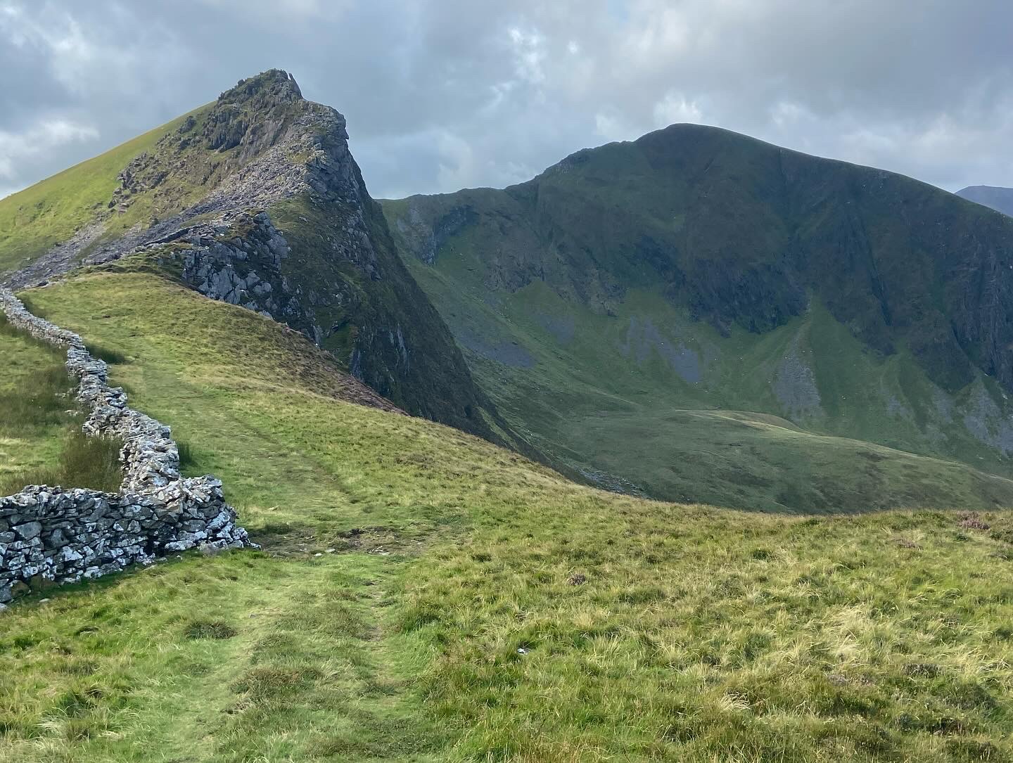
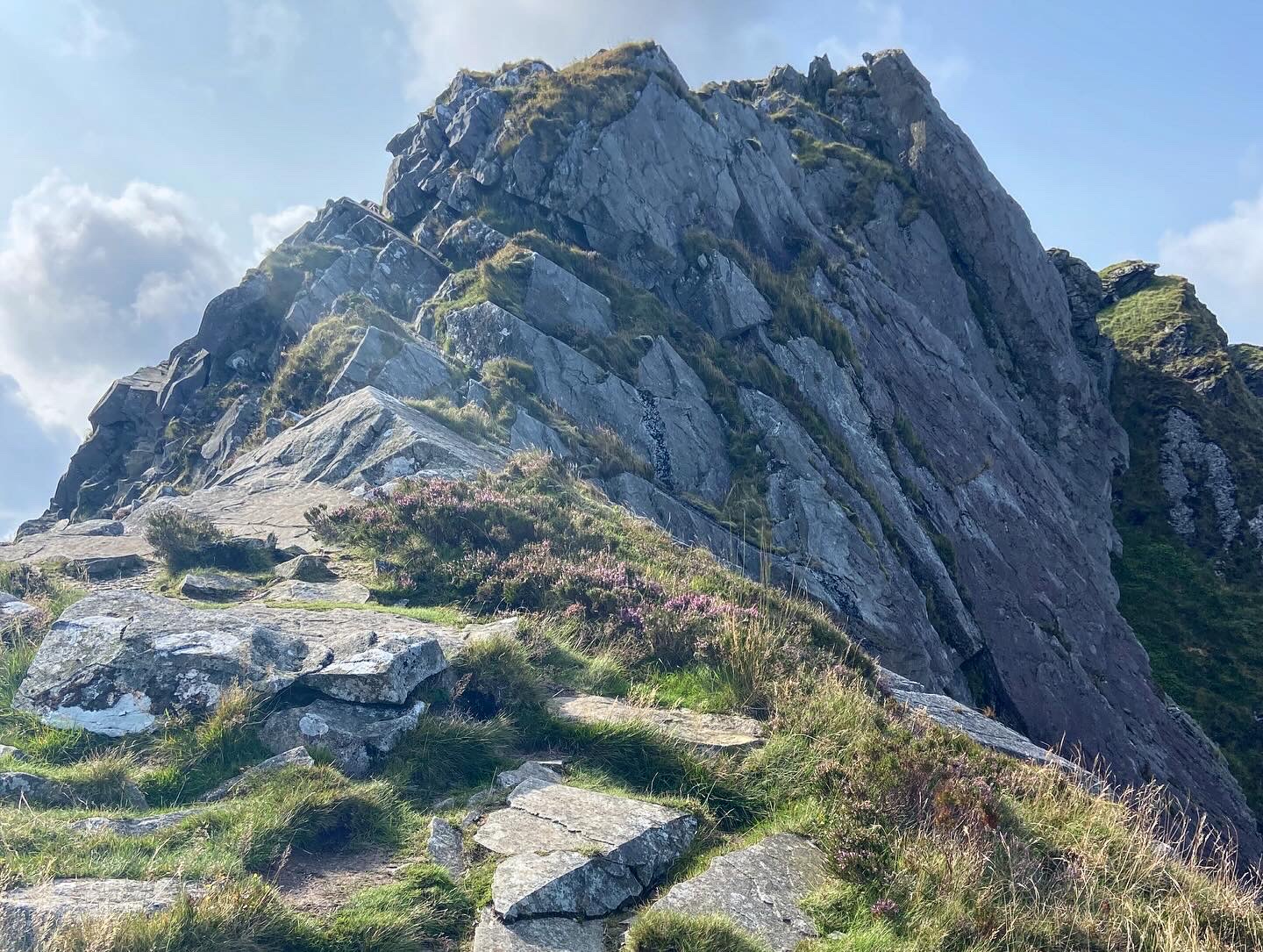
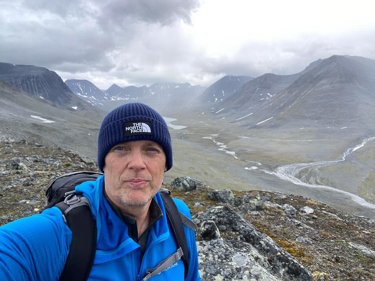
Reaiddanjunni locally known as ‘The Nose’ stands proud at 1,357m and was our first summit of the day. From there, we hoped to continue up the ridge. We aimed to reach an unnamed summit just visible at 1,616m.

The weather was moody and atmospheric for the clamber upwards.

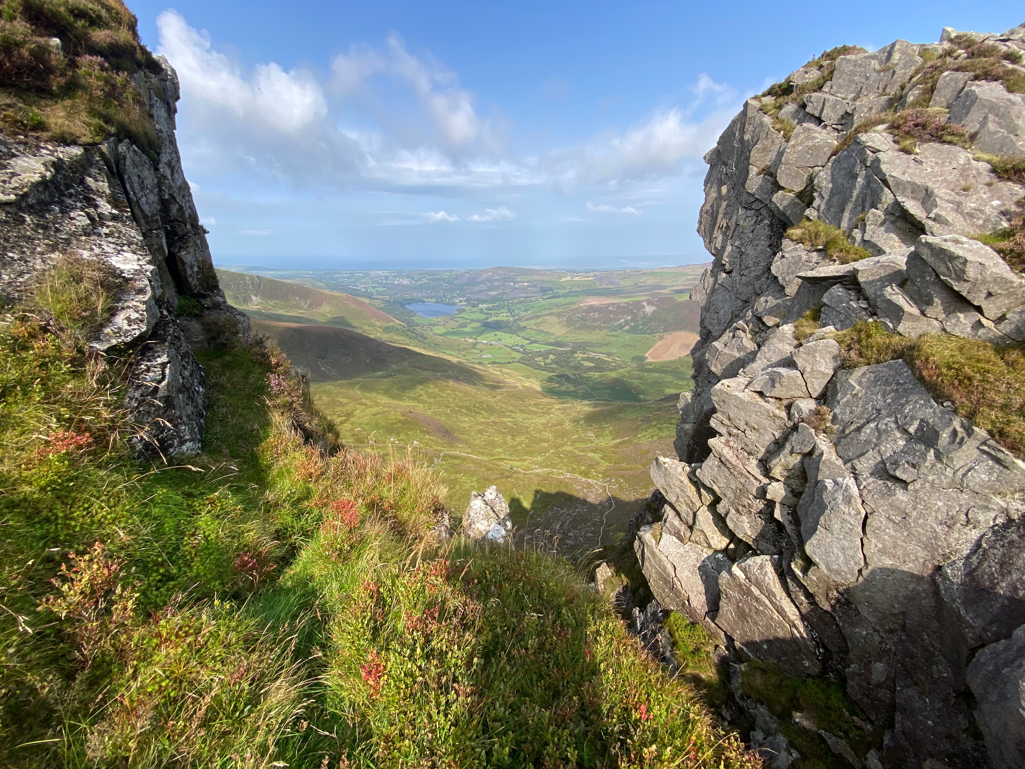
From the final summit, we were rewarded with views. We finally made it after nearly 2 hours of climbing. Now we could see across the arctic landscape as far as Norway.

A great day in a pretty remote place climbing tall wintry mountains…..what’s not to like!

The Kungsleden Day 6.
Salka to Singi. A tough day for me after the mountains of the previous day. Lacking in both motivation and energy it was a slow plod along the glacial valley to camp.

We spotted what seemed like a promising peak. It looked like a peak we could potentially tackle. We thought it might be attacked from a side valley.

Bushwhacking up said valley we finally made camp on a blustery outcrop of moraine for the night.

The Kungsleden Trail – Mountain Day 2.
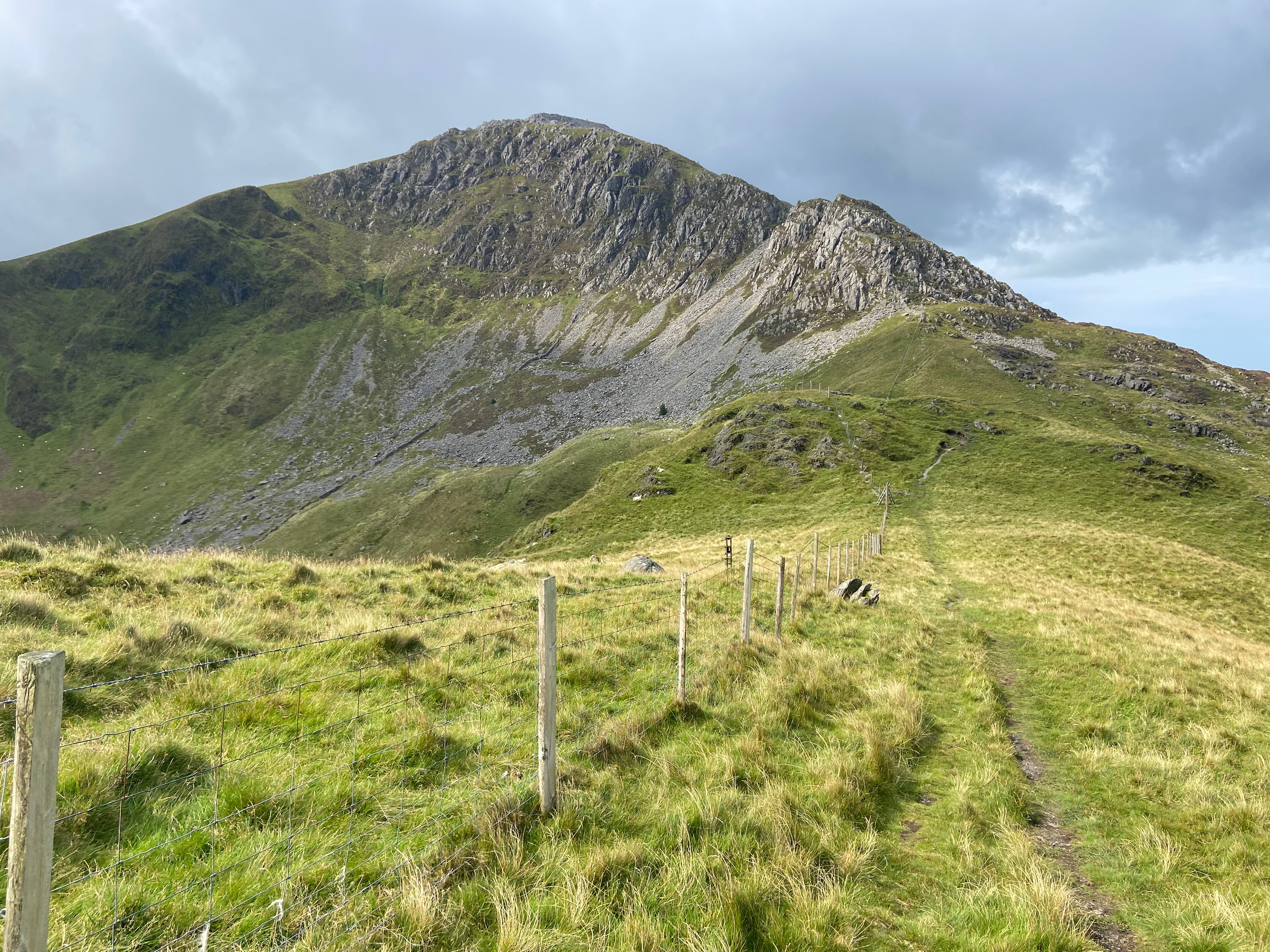
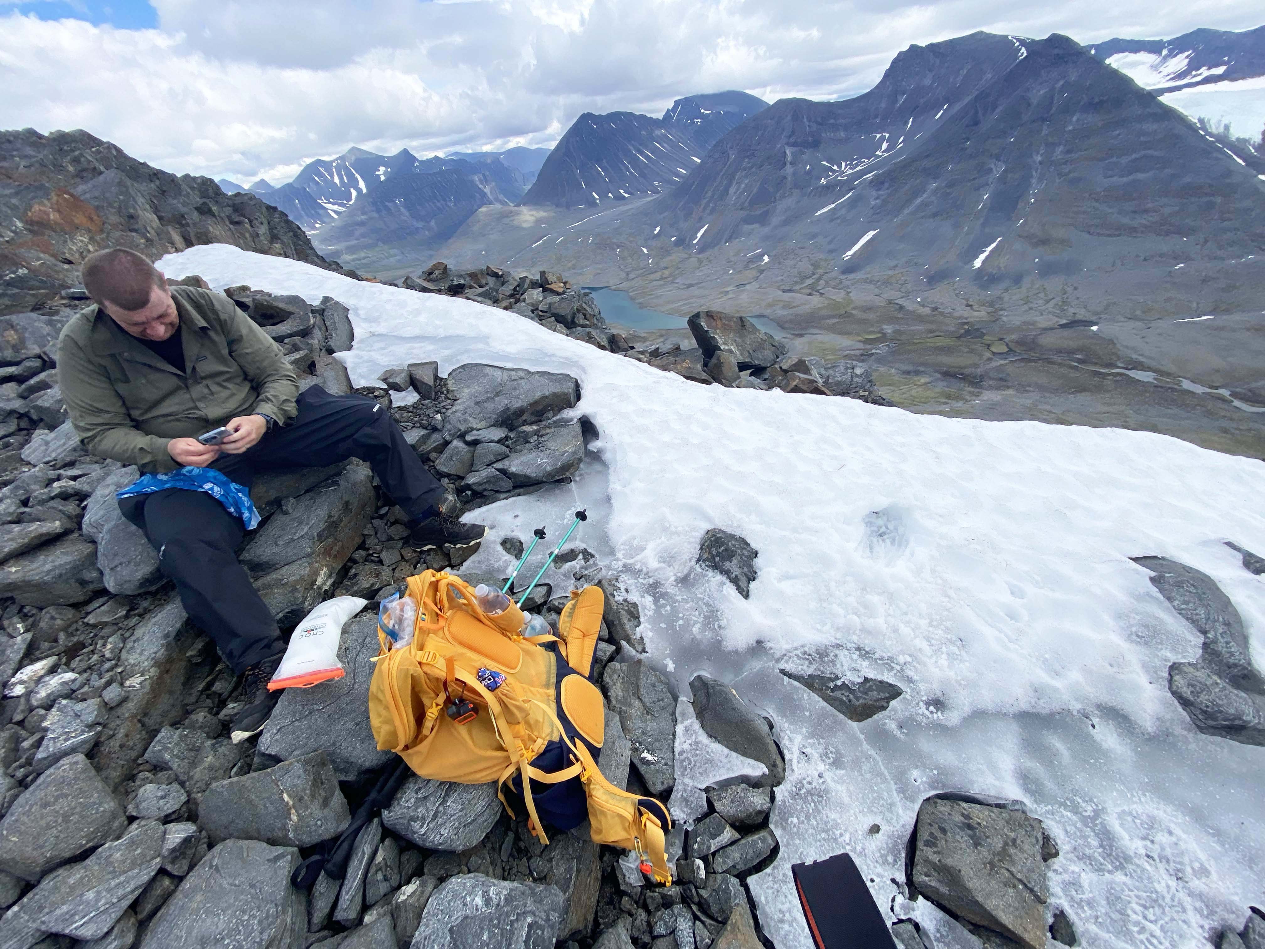
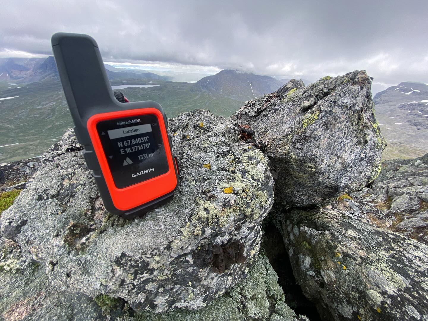
From our wild camp within the glacial side valley opposite Singi we attempted to ascend Unna Avrrik. At 1,331m it was a fairly challenging objective.

The ascent started with a bushwhack across the valley floor before a steep ascent up mixed scree and grass.

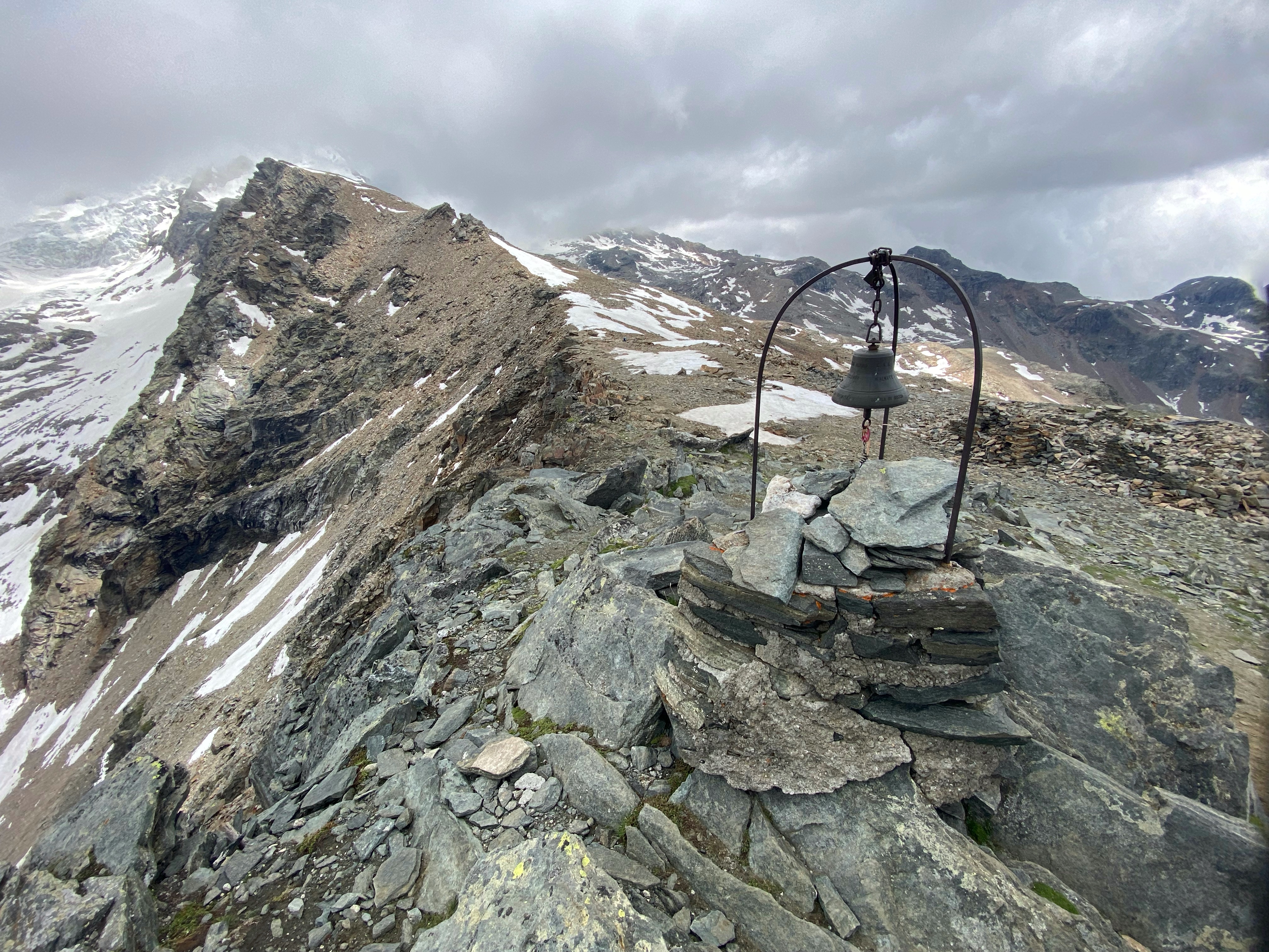
Towards the summit, the terrain became significantly more challenging. Large boulders were present, and there were no standout navigational features to help with route finding. The only aid was the weather station mast on the summit outcrop.

Upon reaching the summit, the weather began to change. A chill wind picked up, and ominous clouds started building along the valley. But the views were sublime across the length of the Tjäktjajåkka Valley.

The Kungsleden Day 8.
Singi to Kaitumjaure approx 16.5km.

A long days walk down the valley after the previous days climbing.

Many hikers leave the Kungsleden here and continue towards Nikkaluokta. On the way to Kaitumjaure we noticed that there were way fewer hikers on the tail.

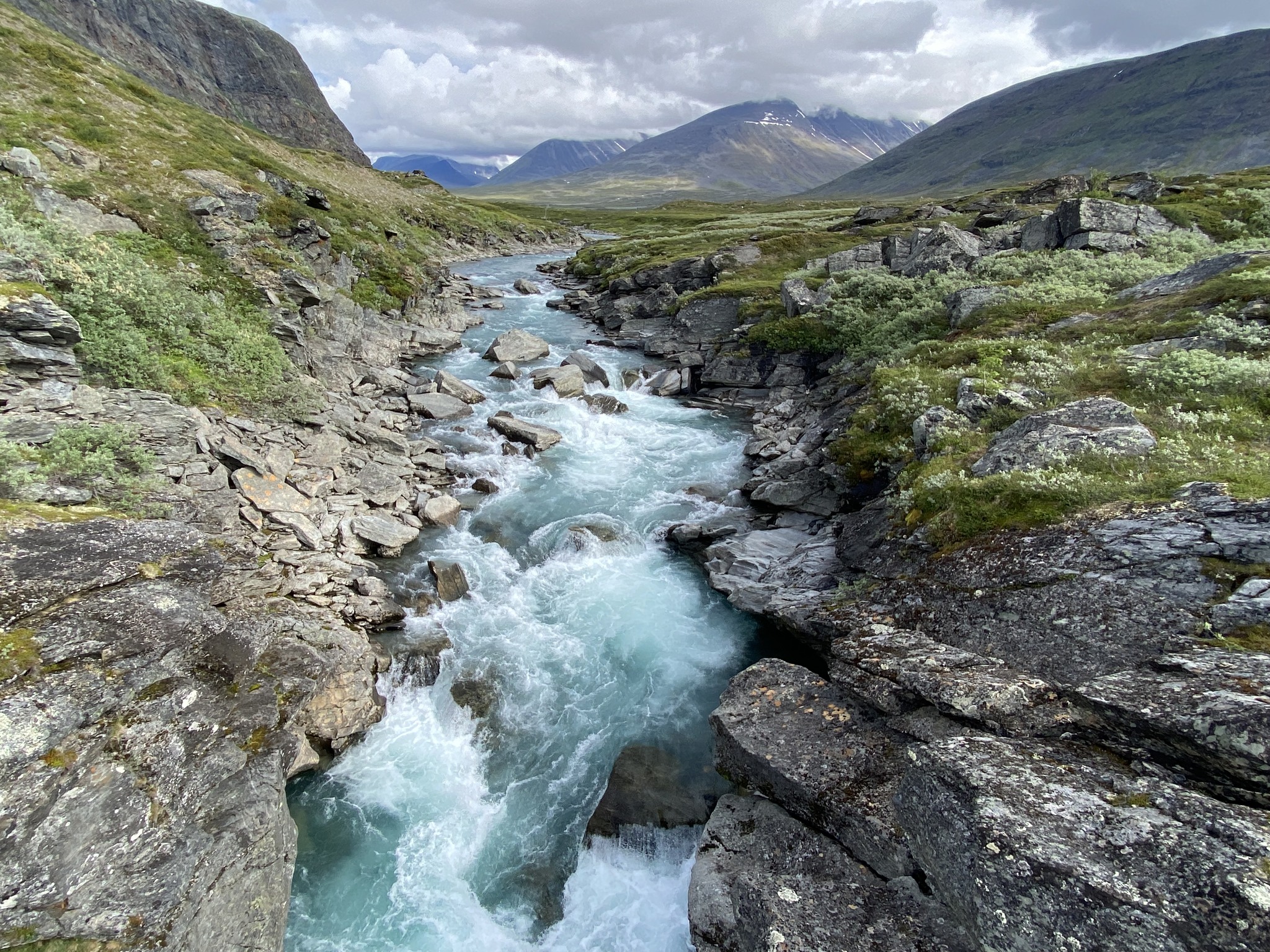
The mountain sides along this section are steep. The valley becomes narrower. The river meanders scenically through the landscape.

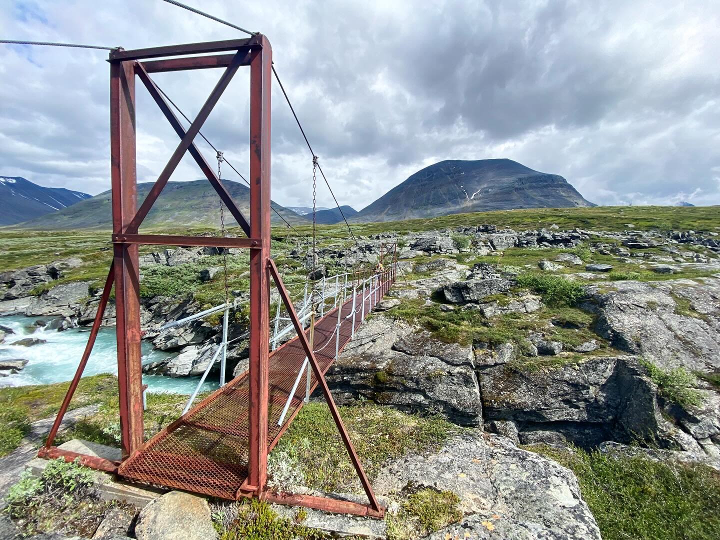
The trail itself was very flat and easy to walk on. After about two-thirds of the distance we crossed the Tjäktjajåkka on a wobbly suspension bridge. From here the landscape changes subtly to light birch forest and numerous willow bushes.

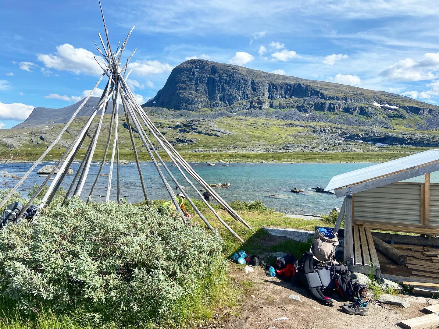
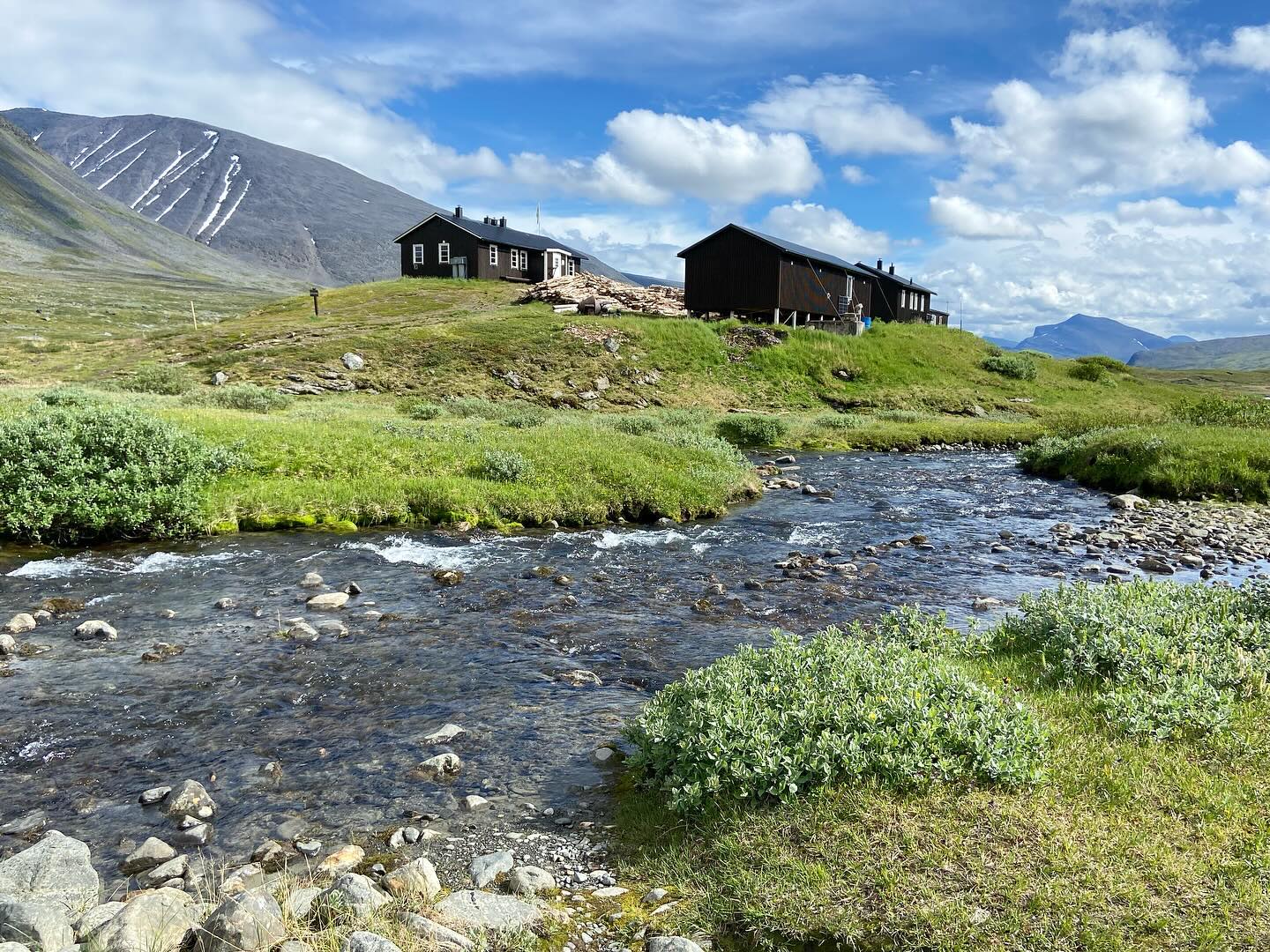
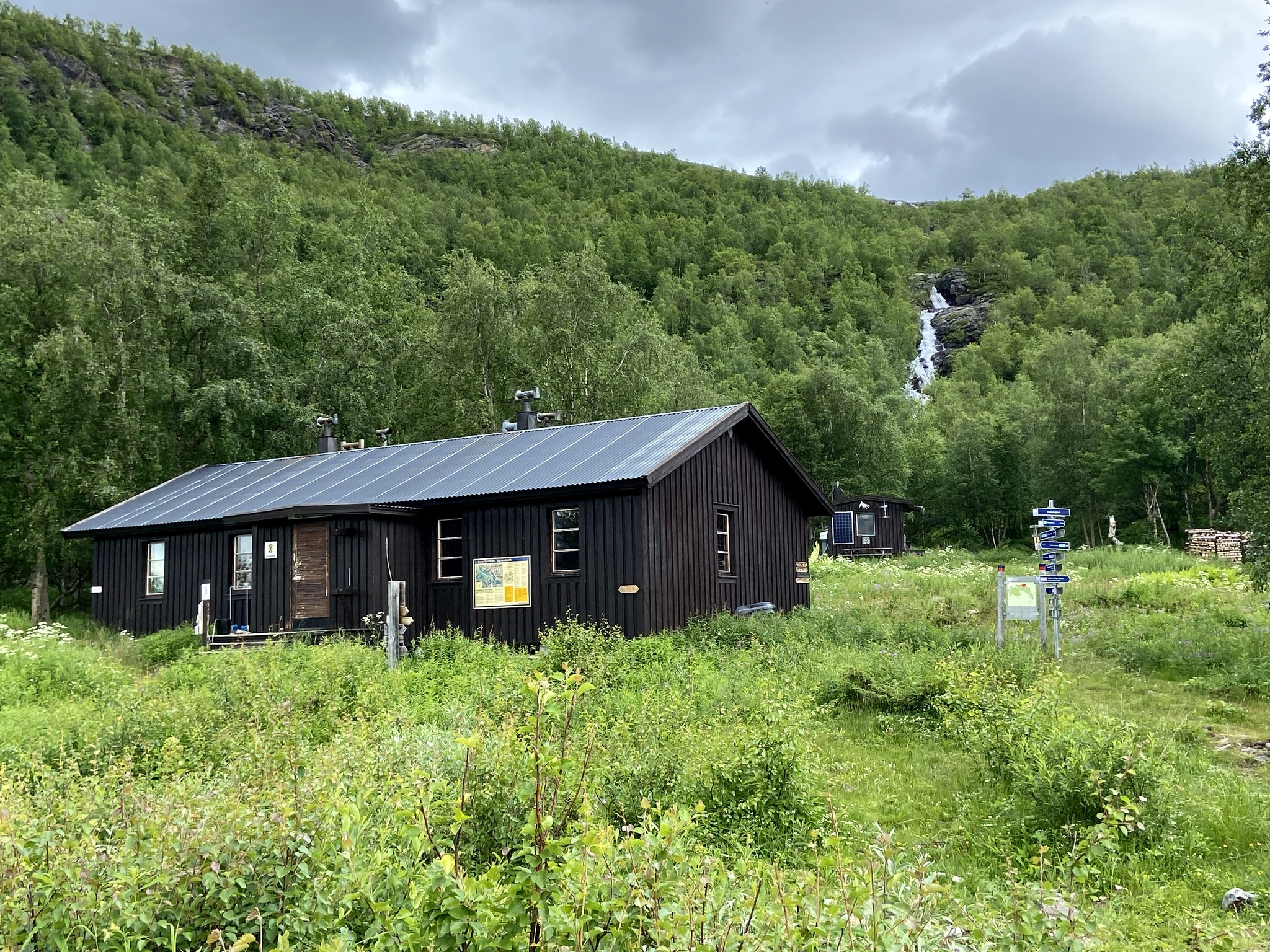
After a while we could see the STF Cabin Kaitumjaure. We were rewarded with a view over lake Padje Kaitumjaure. Its aqua blue glacial waters and the mountains hung majestically on either side.

We camped in the grounds of the cabin overlooking the lake. We enjoyed the delights of our first “Bastu” sauna on the trail. The mosquitoes were merciless but the end of the trail was almost within reach now.

The Kungsleden Day 9.
Kaitumjaure to Teusajaure approx 9.5km.

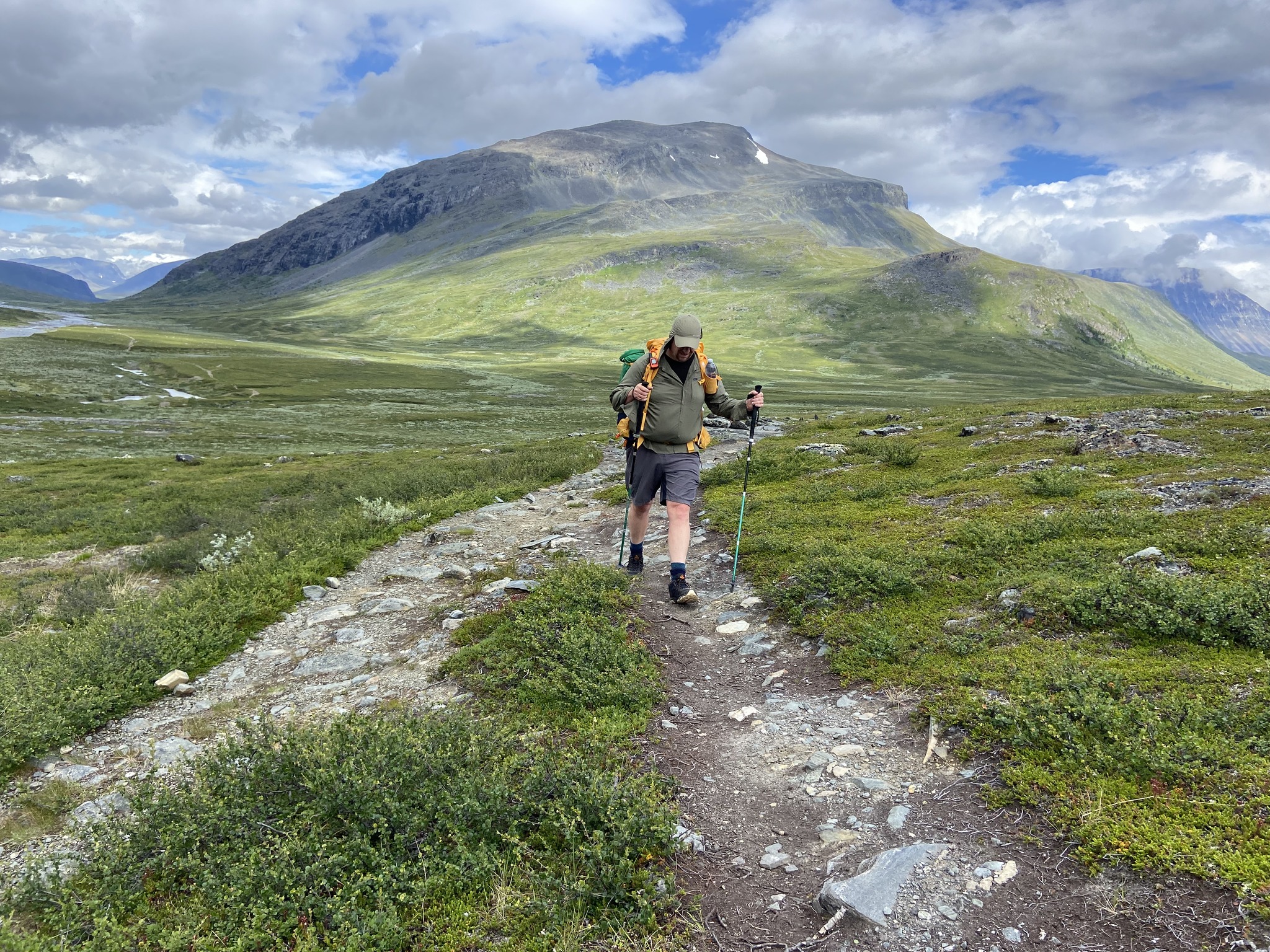
Nice walking today with a long ascent onto a broad mountain plateau. The day finished with a relatively steep descent to Teusajaure by the lakeside.

The day started off with a descent towards the fast flowing Kaitumjakka river. We encountered another magnificent chain bridge to cross.

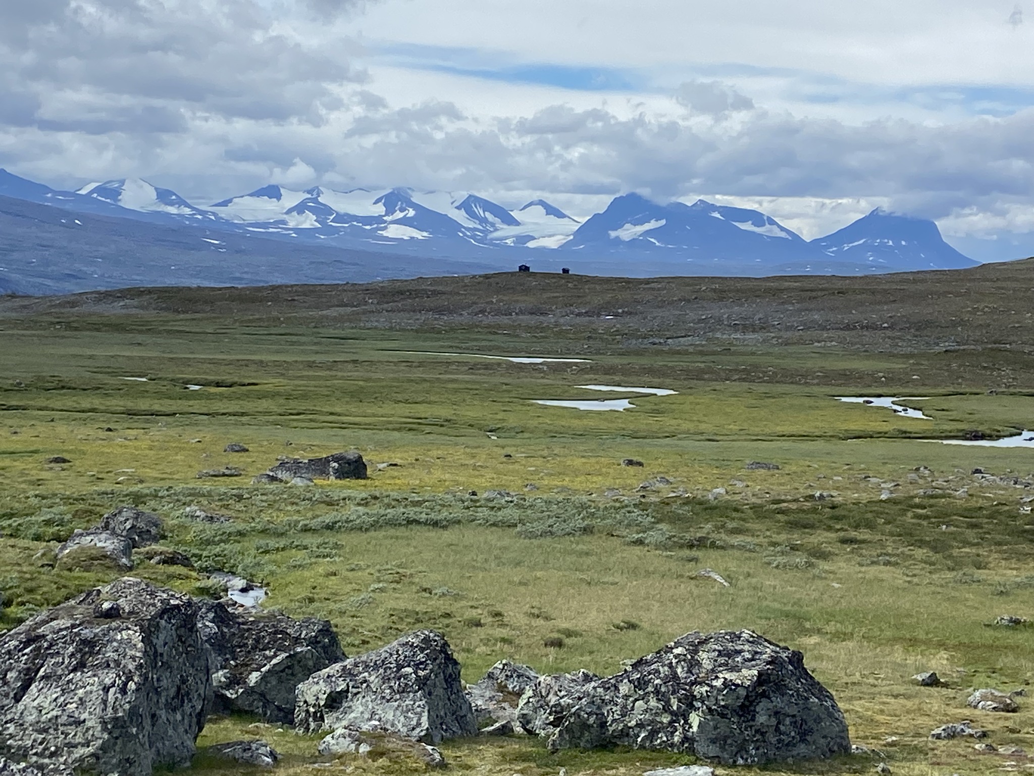
After that, the climb was gradual up onto the plateaux. Once reached, it afforded us extensive views across the magnificent landscape. We saw the snow capped Sarek Mountains glimmering in the far distance.

The traverse at the end of the day down off the plateaux to the camping spot at Teusajaure was steep. It dropped parallel to a cascading stream.

Once at Teusajaure, we decided not to take the ferry across the lake. The area was so beautiful. It would have been criminal not to spend a night camping there peacefully beside the lake.

The Kungsleden Day 9.
Teusajaure to Vakkotavare approx 15.3km.

The last days hike! After a peaceful if mosquito ridden night at Teusajaure we woke up for the early ferry across the lake. The cabin warden from the fjällstation also provides the ferry service. For a small fee, we were ferried across the spectacular lake in the morning drizzle.

After the 1 kilometre boat crossing, the trail continued up a long, gradual climb through mountain birch forest. Eventually, this gave way to brush and grass-covered moors and the hiking became easy.

The trail passed through Stora Sjöfallet/Stuor Muorkke National Park. It provided good views of the jagged summits of Sarek in the distance.

The last part down to Vakkotavare and the big road was steep and winding. Our journey’s end was a night camping opposite the Vakkotavare fjällstation by the roadside. On the plus it did overlook a lake. This though was a rather unglamorous place to spend what had been a pretty epic trip.

Travel Details and Logistics Involved
FlightsBA from Heathrow to Arlanda (Stockholm). Then, an internal flight from Arlanda (Stockholm) to Kiruna with SAS Airlines. We stayed for a night in Kiruna. Alternatively, you can take a train instead of the internal flight. The trains are unreliable. The franchise that runs this particular line was in the midst of a change of owner from its Norwegian bosses when we traveled. The Swedish/Norwegian rail company was called SJ. You could choose different options, ranging from just seats to first class private compartments.

Hostel in Kiruna – SPiS i Kiruna – at the time of writing this post the hostel is no longer available. It is on land in Kiruna and is being demolished or moved to a new location due to subsidence caused by mining beneath the town. Cost in 2024 for the hostel was around £72 a night per person. There are many other options of places to stay in a town the size of Kiruna.

Bus to Abisko – The bus timetable we used was a summer schedule. It became available at the end of May. We caught an 8.25am departure from Kiruna the following morning, arriving at Abisko Turist at 9.40am, ready to hit the trail.

Details and information about the trail can be found on this useful website by the Swedish Tourist Association:
https://www.swedishtouristassociation.com/areas/kungsleden/

We chose to wild camp and only use the huts sparingly. In Sweden they’re called fjällstuga which can be translated as mountain cabin. Some are prettier than others but they all are located at some of the most beautiful locations along the route. There are smaller and bigger ones but as you are in Sweden all of them have their own sauna. Their opening dates can vary each year, here is a list for 2024.

Sleeping there costs approximately 500SEK / 50€ / $50 a person/a night. Remember that during peak season you definitely must book beforehand! Paying this fee allows you to have access to a comfy bed, a warm kitchen & the mentioned sauna. No hot running water, no electricity tho.

You can pay around 350SEK / 35€ to pitch your tent close-by. You can use the heated kitchen to cook. If you just want, you can also use their toilets or hop into their kiosks. We did this at three of the huts along our route.

To get discounts on the huts along Sweden’s Kungsleden trail, you should join the Swedish Tourist Association (STF) online. Become a member to enjoy these benefits. Membership provides a discount of 100 SEK per night for adults at STF mountain huts and stations. This discount quickly offsets the membership fee. You can pay for your membership and book your stays in advance through the STF website.

Return Journey – this was a nightmare. The train we had booked was canceled. We spent hours at Gallivare Station waiting for a train that did not appear.

We were put on a coach. We then traveled 4 hours along the line to another station where we were supposed to catch the train, which never appeared.

Now being 1am in the early morning, we desperately decided to order a taxi. We used a phone app to take us across the arctic countryside to Lulea Airport where we slept in the corridor. There, we eventually caught an internal Norwegian Airways plane back to Stockholm at 9:15am then onto Heathrow.

The plane trumped the unreliable railway but at a much greater expense.

Winter Mountaineering Adventure: Battling Tough Conditions in Scotland | 2024

Gairich

In January I was invited along by two lads Malc and Paul that I’d met while in Nepal to join their winter trip up to Scotland to try and bag some remote Munros in the Highlands.

I have limited experience of winter conditions in Scotland having been only twice before to sample its unique delights.

Winter is an ephemeral thing in Scotland and predictable winters are few and far between these days with conditions ever changeable due to either global warming, periodic climatic shifts or whichever other theory you want to choose from.

The Winter of 2024 would prove again to be highly unpredictable. As chance would have it on the weekend that we had all chosen to make our trip up to Scotland she was battered by some of the worst and relentless storms seen up there in over forty years!

Having all arrived in Fort William our first day greeted us with dashing cold rain, sleet and a blustery wind outside. With it still dark we kitted up and left the comfort of our rooms for our first challenge, Gairich!

Loch Quoich

Gairich lies along the southern side of Loch Quoich. It is 919m tall and is nearly always climbed from the Loch Quioch Dam which was coincidentally also our intended route starting at grid reference NH070024

Despite its relatively low height the mountain is rough and quite isolated. The guidebook described the mountain as thus: The dam wall is crossed and a path is picked up which goes south for 2.5 kilometres to reach the lower part of the east ridge. It is then a five kilometre climb up the ridge to the highest point, crossing the subsidiary top of Bac nam Foid (584 metres) on the way. The final section to the summit is a steep climb with one tricky and narrow bit.

The Scottish Highlands

The weather was overcast and cold with light sleet and snow. We trudged across some marshy bogs and peat to finally reach the start of the ridge. There we were greeted with pockets of sludge and snow under a fine layer of thin ice.

Gairich

The mountain looked magnificent though, covered in a layer of white snow with the summit clearly visible to us all.

The snow on the flanks was deep and at times up to our waists as we made our way up. We made deep snow steps as we ascended, using the ice-axe only when needed. The crux was as described both tricky and narrow, with the added jeopardy of cornices on the leeward side of the arete.

After some careful foot placement we found ourselves on the summit slopes. The wind was battering us hard and the visibility fell dramatically, but soon enough we made it to the summit cairn.

On the summit of Gairich

Malc and myself on the summit of Gairich

The views were non-existent and with the weather worsening we quickly congratulated ourselves on a job well done for having made it to the top. Now it was time to beat a retreat before the conditions worsened.

Sliding, slipping and occasionally making the correct moves we scuttled off the hill. Beers were enjoyed that night back in Fort William by all.

Day Two came about with even worse weather to greet us in the early hours of the morning. It was still dark at 7am that morning as we left our rooms for the days objective, a double header of A’ Chralaig and Mullach Fraoch-choire.

That day Storm Isha was being forecast to hit Scotland with extreme wind, rain and snow! The storm had not fully arrived yet but the portents were not looking good! But we had decided to try our luck anyway.

A’ Chralaig and Mullach Fraoch-choire are both near the Cluanie Inn in Glen Shiel. A’ Chralaig is the highest peak along Glen Shiel. She is is a massive mountain and despite being lesser known than many of her neighbours is actually the highest summit in Kintail. The summit of Mullach Fraoch-choire is a short distance beyond and was the second intended Munro of our day at a whopping 1102 metres.

A’Chralaig started with an unrelenting climb to 735m through heavy snow with only glimpses of blue skies afforded us. The steepness gradually gave way to some easier terrain but the wind picked up and the battering made for a very tough climb.

Crampons were pulled out and put on for the final summit mound push. The wind was gathering a pace and I faffed around to secure my crampons firmly on my boots. The ground underneath was razor sharp ice with spindrift battering my face, cocooned inside my winter jacket I was beginning to wonder if this was all beginning to look like an ill-judged venture!

Tackling tough conditions on A’ Chralaig

After what seemed like ages isolated in a world of my own doubt hidden behind snow goggles, various layers and hoods we all made it to the summit of A’Chralaig, a miserable and cold place at 1120m.

To continue on at height along the ridge to Mullach Fraoch-choire in the conditions we now faced would have been folly, so we sensibly and much to my relief turned back down the way we came and retraced our steps.

Good decision making, but frustrating nonetheless. A tough decision to make but the right call with -15 windchill and very strong winds gusting at over 45 miles an hour.

We retreated back down to the Landour Bakehouse housed in an old fashioned Bothy, situated just across the road from the Cluanie Inn. We ate cake!

Storm Isha continued to batter Scotland mercilessly and we had to concede defeat on the last of the planned days outing so instead we all decided to return home. The trip was a bit short on summits achieved but it was big on character building lessons learnt in the mountains. Scotland delivered us a winter trip long to be remembered!

Tackling the Monte Rosa Massif: A Bucket List Alpine Adventure

The Monte Rosa Crew 2023

I’d been thinking about this trip for something like seven years before I actually got off my lazy backside and went and actually tackled it.

The Alps are traditionally the proving ground for mountaineering before venturing into The Greater Ranges, but my CV in The Alps was sparse in many places.

Yes, I’d climbed Gran Paradiso in The Italian Alps, Triglav in The Julian Alps and various other 2,000-3,000ers in Austria, Bavaria and The Dolomites. But there were still so many famous mountains in The Alps that I’d never even seen let alone had a chance to climb.

With that in mind The Monte Rosa Massif on the Italian/Swiss border ticked all the boxes as a destination. There is nowhere in the Alps which has such a high concentration of 4000m peaks than the Monte Rosa group.

The Spectacular Lys Glacier

It’s mountains are historically significant with many famous peaks, and it has some big numbers in terms of stats. Some of those stats include: The second highest mountain in The Alps ‘The The Dufourspitze‘, the highest mountain hut in The Alps The ‘Margherita Hut‘ atop the Punta Gnifetti (Signalkuppe) at 4,554 metres and a range of summits that could be very nicely linked and climbed together.

What I’d been looking at was a variation on the famous ‘Spaghetti Tour‘ which weaves its way over and around the biggest peaks on the Italian/Swiss border.

On my wish list were the following peaks: Piramide Vincent (4215m), Ludwigshöhe (4341m), Parrotspitze (4432m), Signalkuppe (4556m) and Zumsteinspitze (4563m), including if possible a stay in that highest refuge in the Alps, the stunningly located aforementioned Margherita Hut.

This region of lofty summits, once very remote is these days easily accessible from the Italian side by a comprehensive lift and hut system which I’d take full advantage of and as a result it therefore offered some fairly straight-forward glaciated peaks to nab.

Leading the team across the Lys Glacier

With unfortunately not much glacier experience myself I decided the best and safest plan was to go with a guide and a small team, so I booked myself onto a the trip through KE Adventure

I left the UK on a flight from Heathrow and met my fellow teammates at Milan Malpensa Airport. We hired a very small Italian car (too small to be practical) and poodled up into the mountains at a snail’s pace towards the small alpine village of Stafal (Tschaval) in the Aosta Valley (Valle d’Aosta).

That evening at our base the nicely appointed Hotel Nordend in Stafal we met our guide and had a very thorough safety speech, kit check and trip briefing.

Orestes Hut 2600m

The next morning we left Stafal on a gondola bound for the Orestes Hut (2600m). Once we had arrived at the hut we dumped our climbing kit out of our backpacks and ascended with a now much lighter pack up to the Colle Di Salza at 3000m then on up still further to the summit of Alta Luce at 3184m to acclimatise.

This 3185m peak, as well being a good warm up, offered stunning views of the huge glaciers descending from the South face of Liskamm and Piramide Vincent.

Alta Luce Summit 3184m

After a good night sleep and a relaxed breakfast the next morning we left the comfortable Orestes Hut and headed up into the higher world. A good path led up to the Rifugio Mantova Hut at 3500m. From here the glacier starts properly and so in the afternoon we practiced our crampons skills (or lack of) and rope work in preparation for the multiple days of glacier travel ahead of us.

Next morning on what was now Day 3 of the trip we prepared to tackle our first two main objectives from the hut. With crampons on and fully kitted up we started out from the hut slowly starting to ascend the steep lacier towards the Lisjoch.

Piramide Vincent Summit 4215m

First objective was Piramide Vincent which was in theory a straight-forward snow climb. But unfortunately I was suffering with a bad chest infection brought over with me all the way from the UK.

Additionally the day was proving to be an extremely cold one and the wind was biting through to the very bone. I struggled on upward on the ice and snow feeling quite below par up the ever steeper snowy flanks of the mountain. Eventually we reached the summit at 4215m. Bent over double at the top I was gasping for breath!

Next The Balmenhorn, which (much to my relief), was taken off the agenda. The wind chill factor was deemed way too severe by our guide for us all to be standing around for the 15-20 minutes usually required in the single line queue while awaiting your chance to climb up the metal staples placed in the rock to reach the summit.

Rifugio Gnifetti

Instead we beat a quick retreat to the Rifugio Gnifetti. The Gnifetti hut is perched on a rocky buttress in a spectacular position and is an absolutely huge hut with 176 beds, it’s a lively Italian fortress and the food was excellent, but the ensuing nights sleep was noisy and broken.

As the next morning dawned and the realisation that an opportunity was missed yesterday on The Balmenhorn I was hopeful that today would yield us a better haul of summits.

We retraced our steps of the previous day this time heading for the Lisjoch at 4200m. We had three peaks on our radar for the day. Ludwigshohe (4341m), Parrotspitze (4432m) and then to ascend to the Rifugio Margherita on the summit of the Signalkuppe at 4554m.

Ludwigshohe Summit 4341m

Early doors a successful ascent of Ludwigshohe rewarded us with some great views. The weather was still bitterly cold but the wind had died down thankfully compared with yesterday and I made the summit feeling quite chipper!

Ludwigshohe Summit 4341m

But then a group decision was made to bypass the Parrotspitze (4432m) and head further upwards for a bigger reward, the summit of the Zumsteinspitze (4562m) not originally on today’s agenda. The summit was the furthest away and it was the highest on our to do list, but conditions were looking near perfect for an ascent.

So I agreed with the team that we should try for it as conditions were so favourable. I was if truth be told disappointed to be missing out on an ascent of the Parrotspitze on the way but I understood the rationale and we were a group and we were making group decisions.

On the glacier with the Signalkuppe 4554m and Zumsteinspitze 4562m in the distance

So we instead hiked on higher up the Lys Glacier in our iced over crampons to Colle Gnifetti 4452m which set us up nicely for a go at the Zumsteinspitze.

This peak proved to be the trickiest so far with some mixed rock and ice to negotiate and a small summit to stand on. But what a summit it was with stunning views across the Alps of the Matterhorn, Liskamm, Castor, Pollux, Breithorn, Dufourspitze and many more!

Zumsteinspitze Summit 4562m

I was anchor on the rope team going up so had to lead going back down and I confess to having my stomach in my mouth more than a few times on the tricky descent.

Teams were coming up past us on the narrow icy path clogging the way and ropes were getting tangled up on the steep slopes. It was with relief that I finally led us back down to the safety of the Colle Gnifetti.

Zumsteinspitze Summit 4562m

After a brief break and refuel at the colle we made our way back over crossing the Lisjoch once again and across to the icy slopes of the Signalkuppe with the Margherita Hut perched atop it. Wearily we trudged up the icy switchbacks to the highest building in Europe.

There is no refuge in the Alps that can compete with the views from this hut! But as luck would have it we had a white out to great us with mass cloud cover rolling in out of nowhere, so no views for us of the either the fabled Po river plains of Italy below or the curvature of The Alps stretching far away!

Outside The Margherita Hut

From the balcony on the Margherita you can also reputedly stare down one of the biggest faces found in the Alps, 2500m of strikingly bare space below you as you lean out over the rickety wooden rails, but alas I will have to return one day to enjoy that pleasure too.

We all spent a fitful and head hurting night of sleep on the summit of the Signalkuppe due to the extreme altitude. The first building was placed atop the Signalkuppe in 1893, it was later replaced in 1980 with the much bigger structure that we slept in. It is officially the highest building in Europe and there is no refuge in the Alps that can compete.

On that final morning we woke from our broken sleep to a freezing fog that engulfed the hut and we sleepily got kitted up in the cramped and chaotic, but also very atmospheric boot room of the famous hut.

Margherita Hut kit room

We ventured outside into the cold morning. We were ready to make our journey back crossing the Lisjoch. Then we descended all the way down to the valley, past the Rifugio Gnifetti, and down to the Rifugio Mantova. There we had some refreshments or lunch. Afterward, we headed down to the ski-lift. We eventually returned to our comfortable valley base hotel.

Descending The Signalkuppe

Looking back at the trip now after nearly a year there are many thoughts running through my mind. Firstly I wish I had not felt so ill before, during, and after travelling. I really was sick as a dog! The chest infection was debilitating. It was annoying in equal measures. To some degree, it did affect my performance and mental outlook while I was there. Antibiotics were the only remedy to eventually shift the illness upon my return.

Descending the glacier

I also wish we had climbed The Balmenhorn and not deviated around The Parrotspitze as they now remain on the still to do list. But at the time I thought it was the best decision regarding both summits and after all hindsight is a wonderful thing in the comfort of your warm house back in England.

One day I might go back to the Monte Rosa range in a way I hope I do as it is an undeniably stunning destination with some fairly easy alpine summits to tackle as well as some very hard mountains to climb if you feel that way inclined (think Liskamm and Dufourspitze to name but two).

If/when I get older, some of the summits might still be doable due to the comprehensive lift system. This system aids in reaching them more easily. I may well appreciate these lifts in my golden years. Until that day comes, the memories of this trip will have to suffice for now.

Trip notes and information:

Rough itinerary outline (changeable due to weather conditions)
DAY 1 – Meet at the group hotel in Stafal.
DAY 2 – Walk up to the Orestes Hut (2600m). Ascend Alta Luce (3185m).
DAY 3 – Walk up to Rifugio Mantova (3500m). Glacier skills.
DAY 4 – Ascend Pyramid Vincent (4215m), and visit the Balmenhorn (4167m). Night in Rifugio Gnifetti (3637m).
DAY 5 – Ascend Ludwigshohe (4341m), Parrotspitze (4432m). Ascend to the Rifugio Margherita on the summit of the Signalkuppe (4554m).
DAY 6 – Ascend Zumsteinspitze (4562m). Return to the valley.
DAY 7 – Departure day.

Transport – Flight from Heathrow to Milan Malpensa Airport.
Hire Car – from Milan to Stafal and back.
Lift Passes – included if you go with a commercial trip otherwise factor in cost.
Mountain Huts – included if you go with a commercial trip otherwise factor in the cost and book early.
Hotel in StafalHotel Nordend.